TL;DR
If you don’t have time to read everything and just want know how I did, scroll to the bottom. You’ll also find my thanks and appreciation down there. :)
What is this craziness?
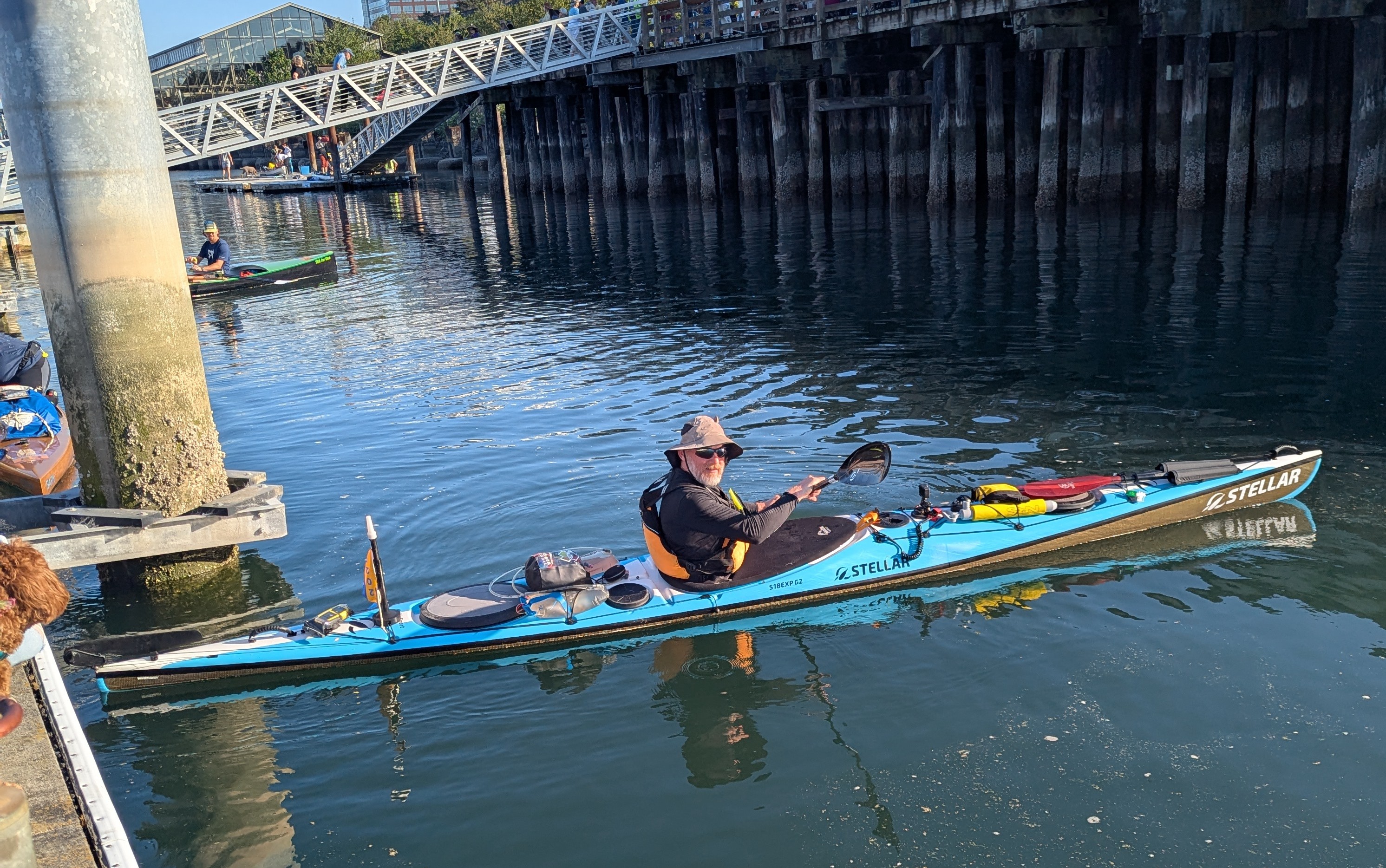
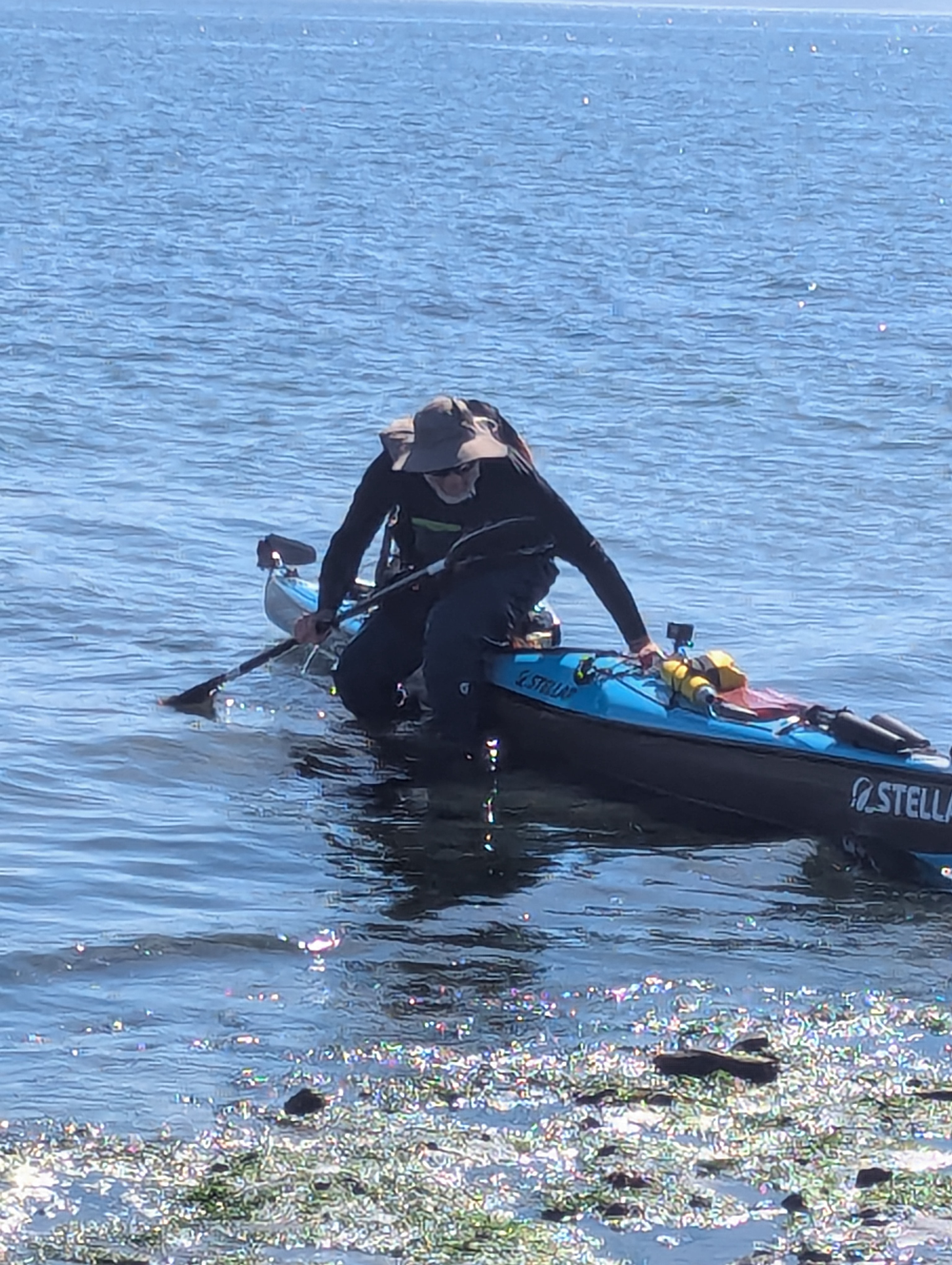
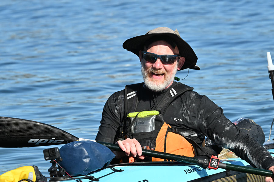
This year, I took on the 7th annual Seventy48 race - my third year in a row! I paddled a Stellar S18 Expedition G2 kayak, which, by the end, felt like my best friend.
For those not in the know, Seventy48 is a human-powered boat race from Tacoma, WA to Port Townsend, WA. The course is about 70 miles, and you have to finish in under 48 hours. (For my east coast friends: that’s like paddling down the Hudson from Poughkeepsie to Central Park - minus the helpful current and plus a lot more salt.)
This year, 110 teams (218 people!) registered. Here’s the boat breakdown:
| Rowboats | 45 |
| Kayaks | 31 |
| SUPs | 15 |
| Surfskis | 6 |
| Outrigger Canoes | 4 |
| Normal Canoes | 4 |
| Pedal Boats | 2 |
| Sailboats (sans sails) | 2 |
Pre Race
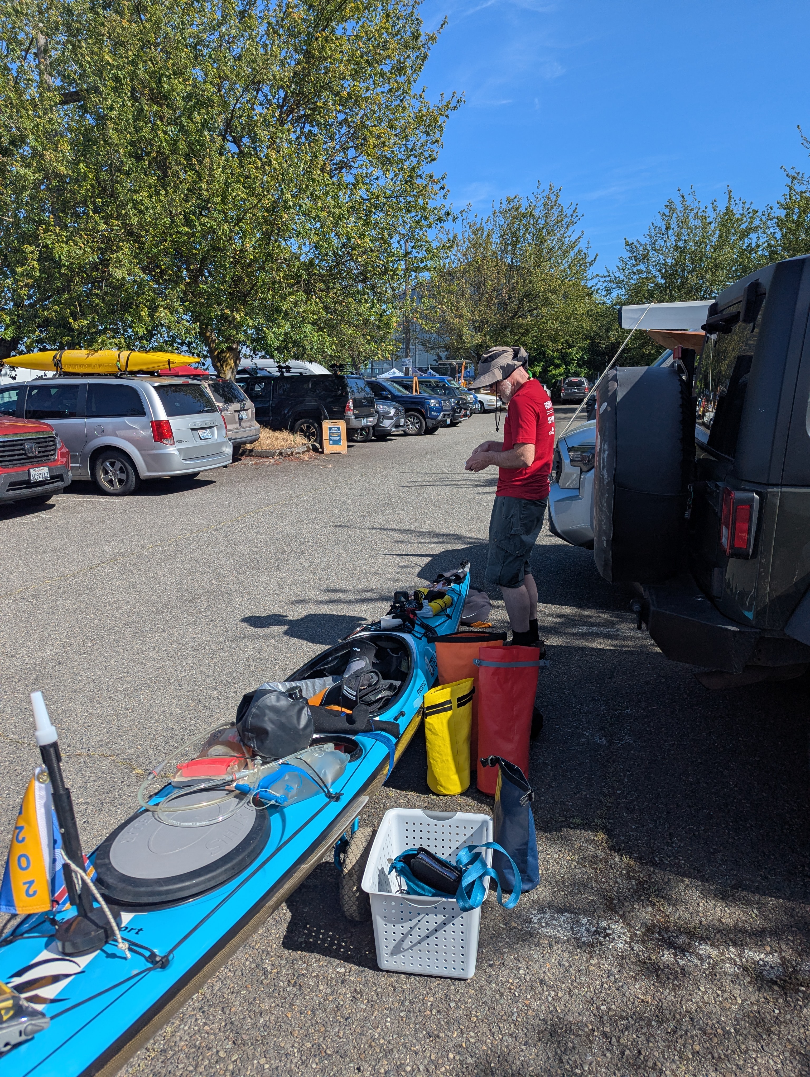
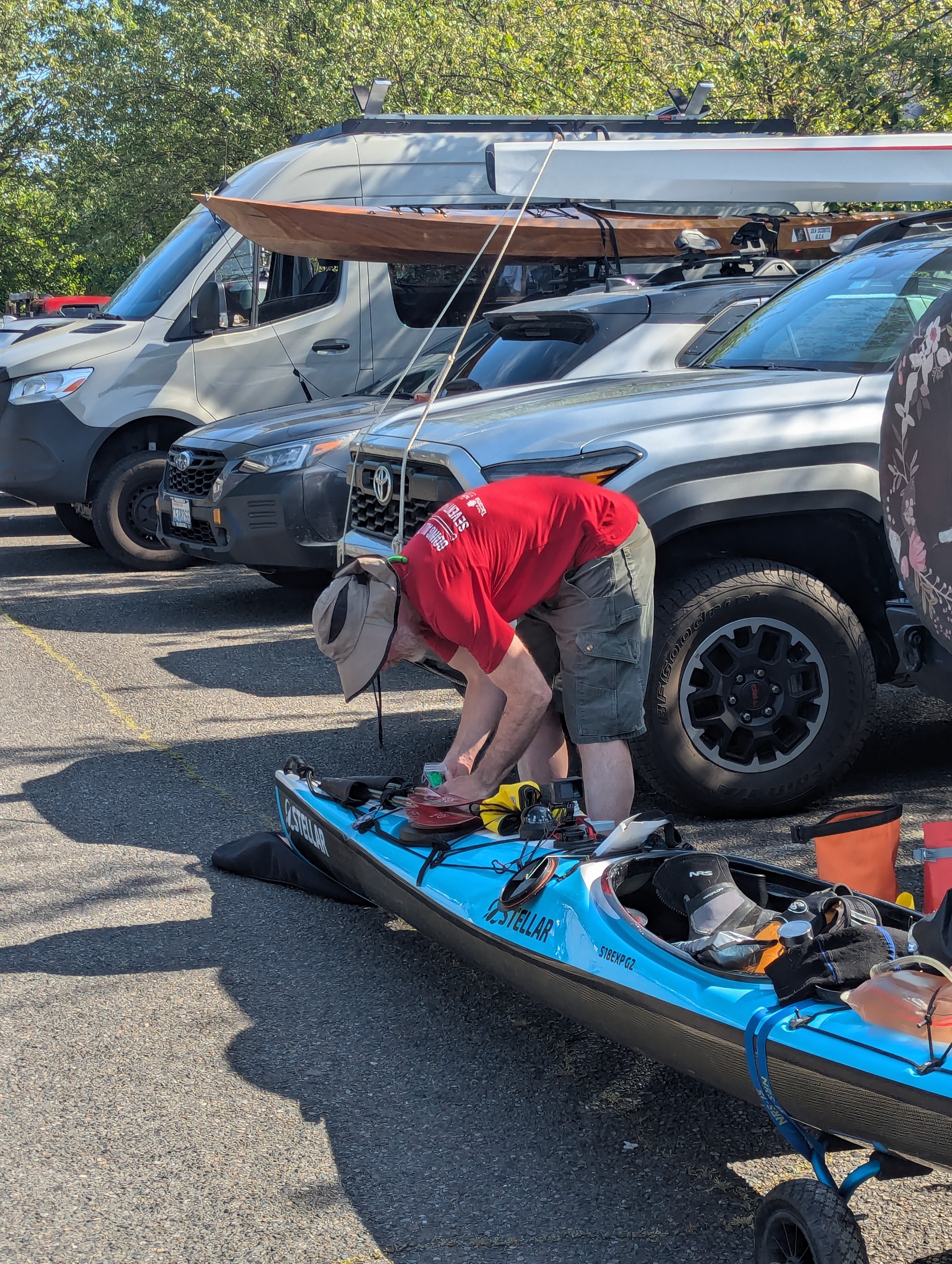
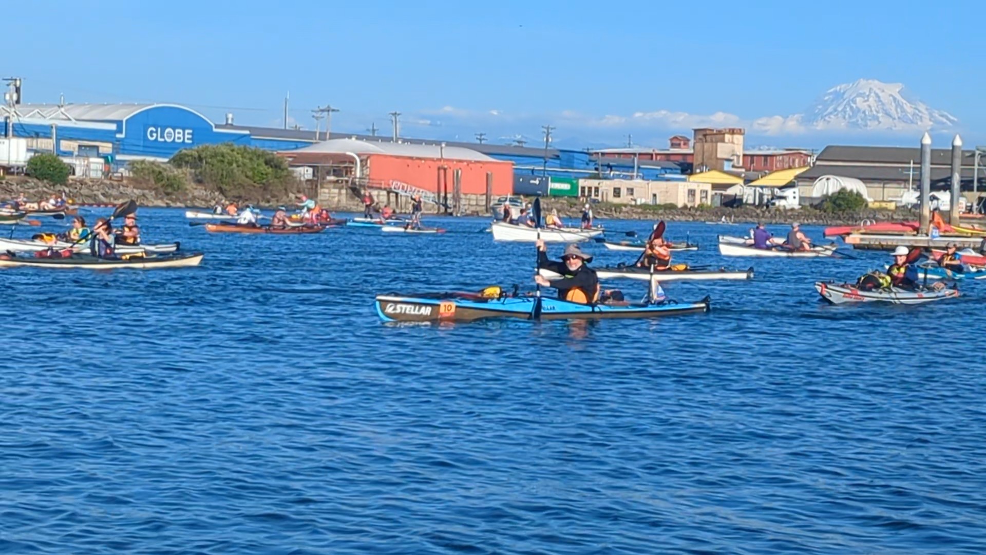
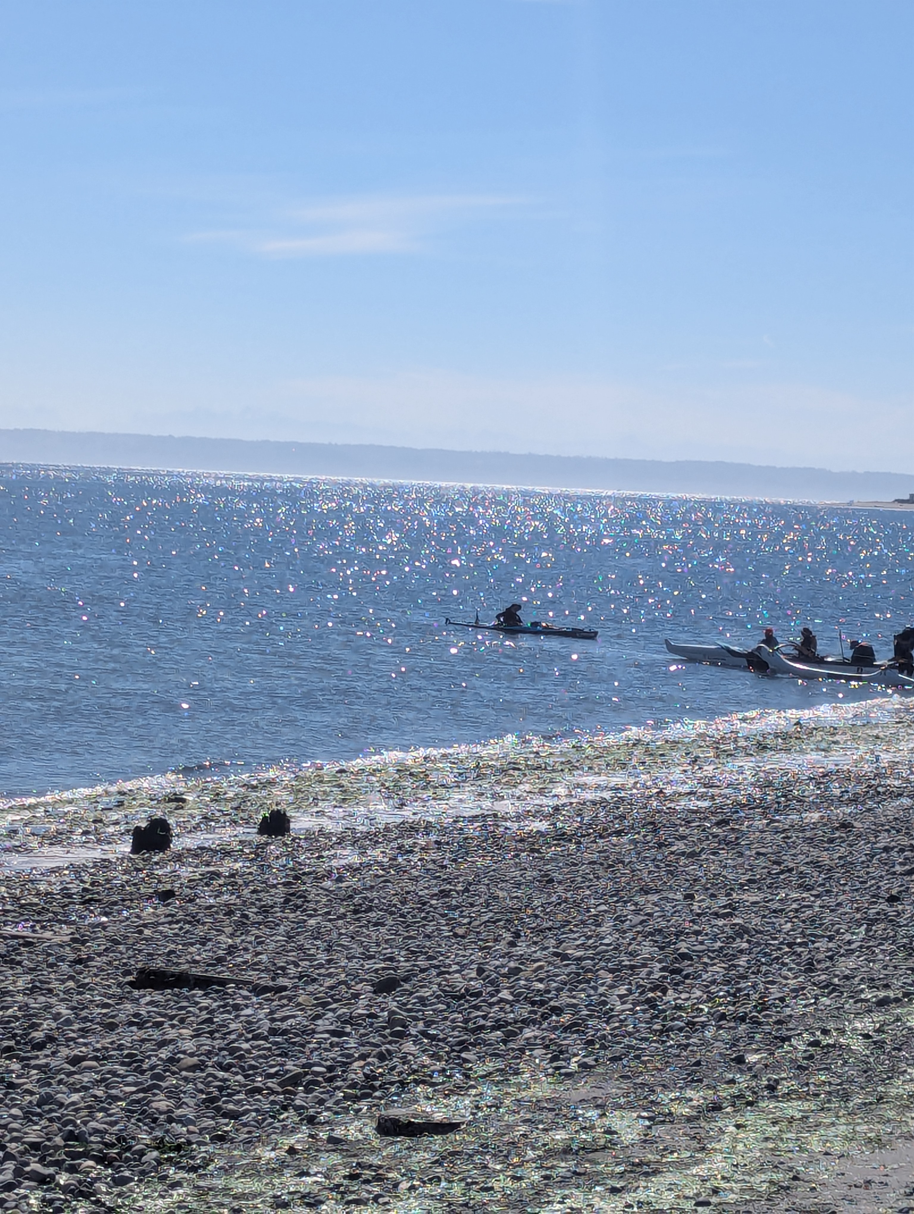
Mary and I arrived at the race start around 3 PM (T-minus 4 hours). I checked in, got my shirt, boat number, and tracker. Boat number 10 - feeling lucky already!
We packed up the kayak (almost everything fit, miracle!), then rolled it down to the docks. I spent a little too much time fiddling with the new bow lights, but hey, safety first.
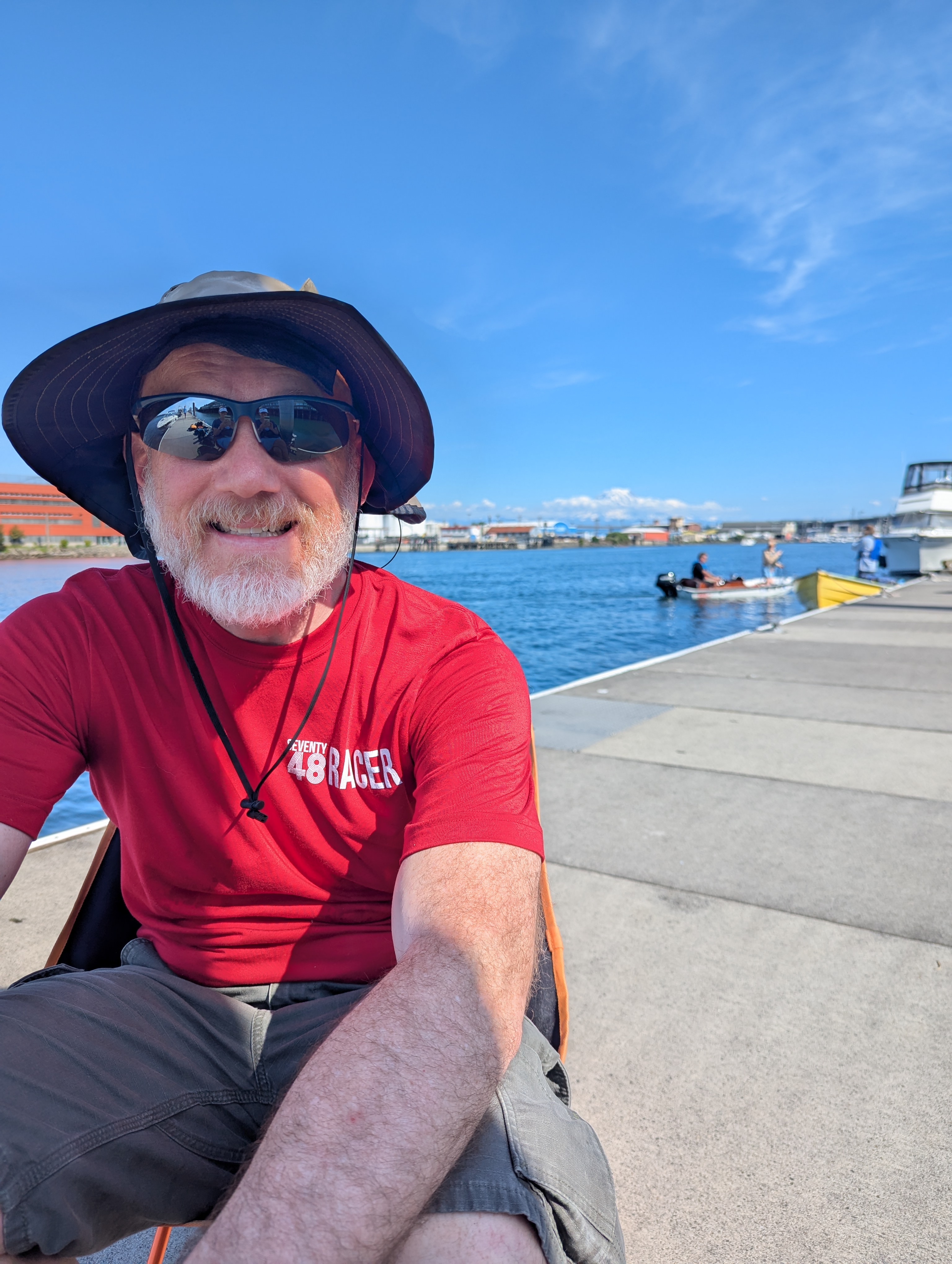
Once we were on deck and mostly sorted, we hung out, joked, and laughed. Mary started painting Mount Rainier, which was showing off in the sunshine.
Our friends Patrick and Sarah (plus their puppy, Elenor!) came to see us off. Having a cheering section is always a boost.
This year, I changed up my gear strategy. In the past, I wore my drysuit with a liner all day, which meant a soggy, cold liner by night. This time, I stashed the drysuit and liner for nighttime and rocked a wetsuit with semi-dry pants and a shell during the day. Lots of practice and rolling with this setup - felt like a solid plan!
The Start
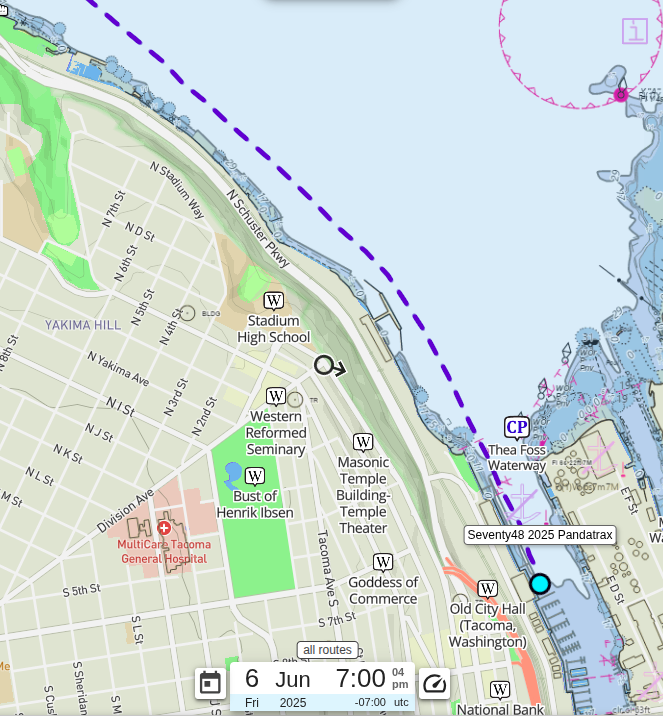
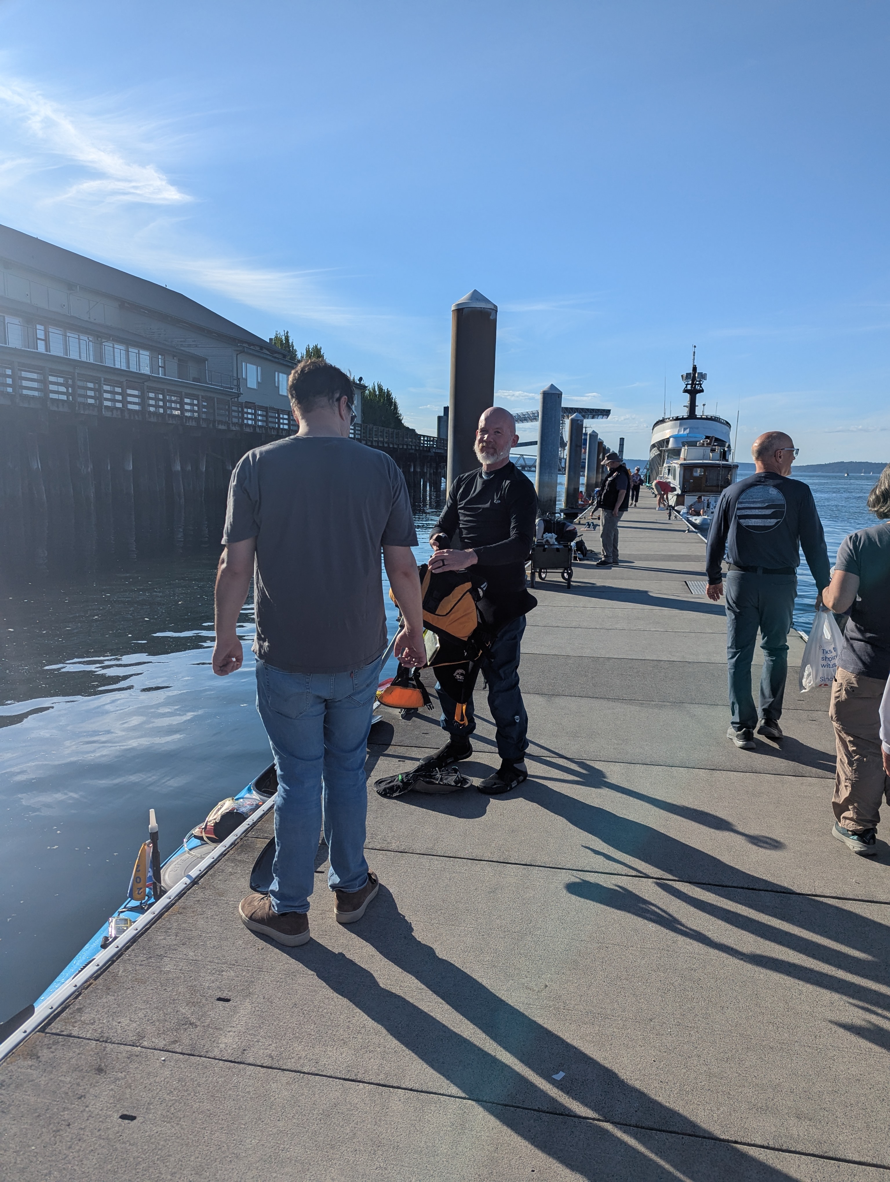
The race starts at 7 PM. Yes, you read that right… 7 PM… as in the evening. Because who doesn’t love paddling into the night? The starting line is at the Foss Waterway Seaport in Tacoma.
Brenna (my daughter) and Joseph (her boyfriend) made it just in time. I got to chat with Brenna and Mary from my boat at the starting line, which helped calm the nerves.
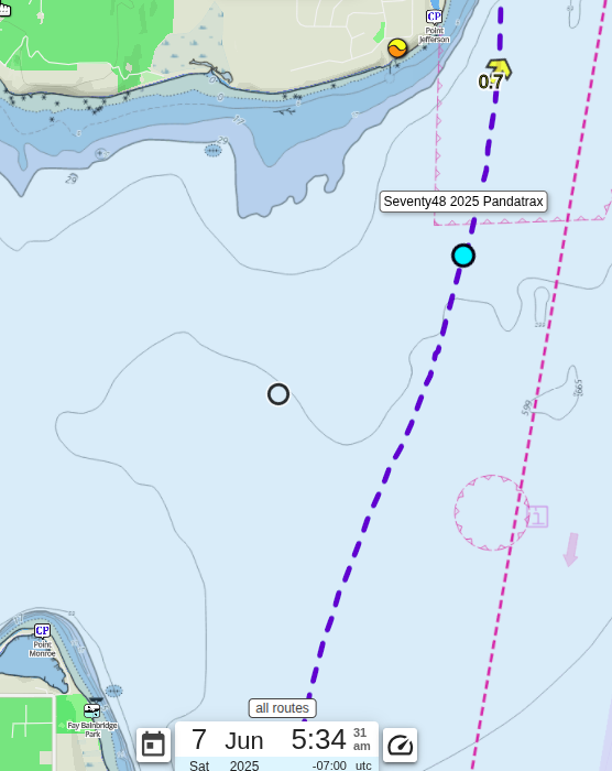
Owen Beach / First Ferry Crossing/ Checkpoint 1
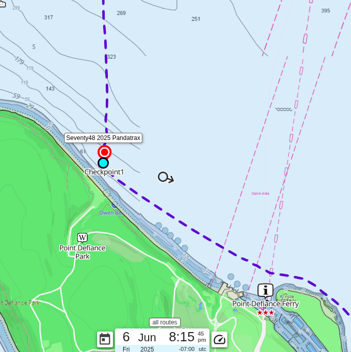
The first of two checkpoints is at Owen Beach, which is about 5.9 miles into the race. I got to the checkpoint at about 8:15 PM (the 1 hour 15 minute mark). It is just past the first ferry crossing. This checkpoint is meant to keep all of the teams passing over the Point Defiance Ferry crossing to one side of Commencement Bay. I was lucky that when I was passing over the crossing, the ferry was just leaving Vashon Island and I didn’t have to wait for it.
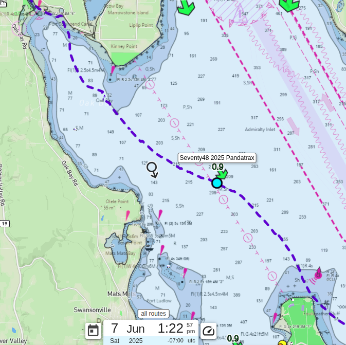
Up to this point, the course is sorta along the shore, so this also signifies the beginning of the first “open” water crossing. I was feeling really good at this point.
Lisabeula
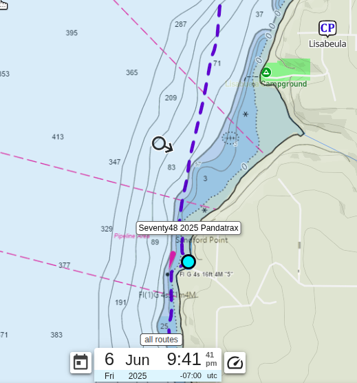
After crossing into Colvos Passage, the sun was beginning to set. One of my goals for this race was to get to Lisabeula campground before it was dark. This would be a first for me on this course.
At 11.7 miles, it was 9:41 PM (the 2 hour 15 minute mark). I decided on pulling over for the first time right before Lisabeula in order to turn on my stern and bow lights, as well as stand up and get a little stretch in. As I was standing there, it was a bit sad to watch teams passing me, but the break was worth it and my back thanked me.
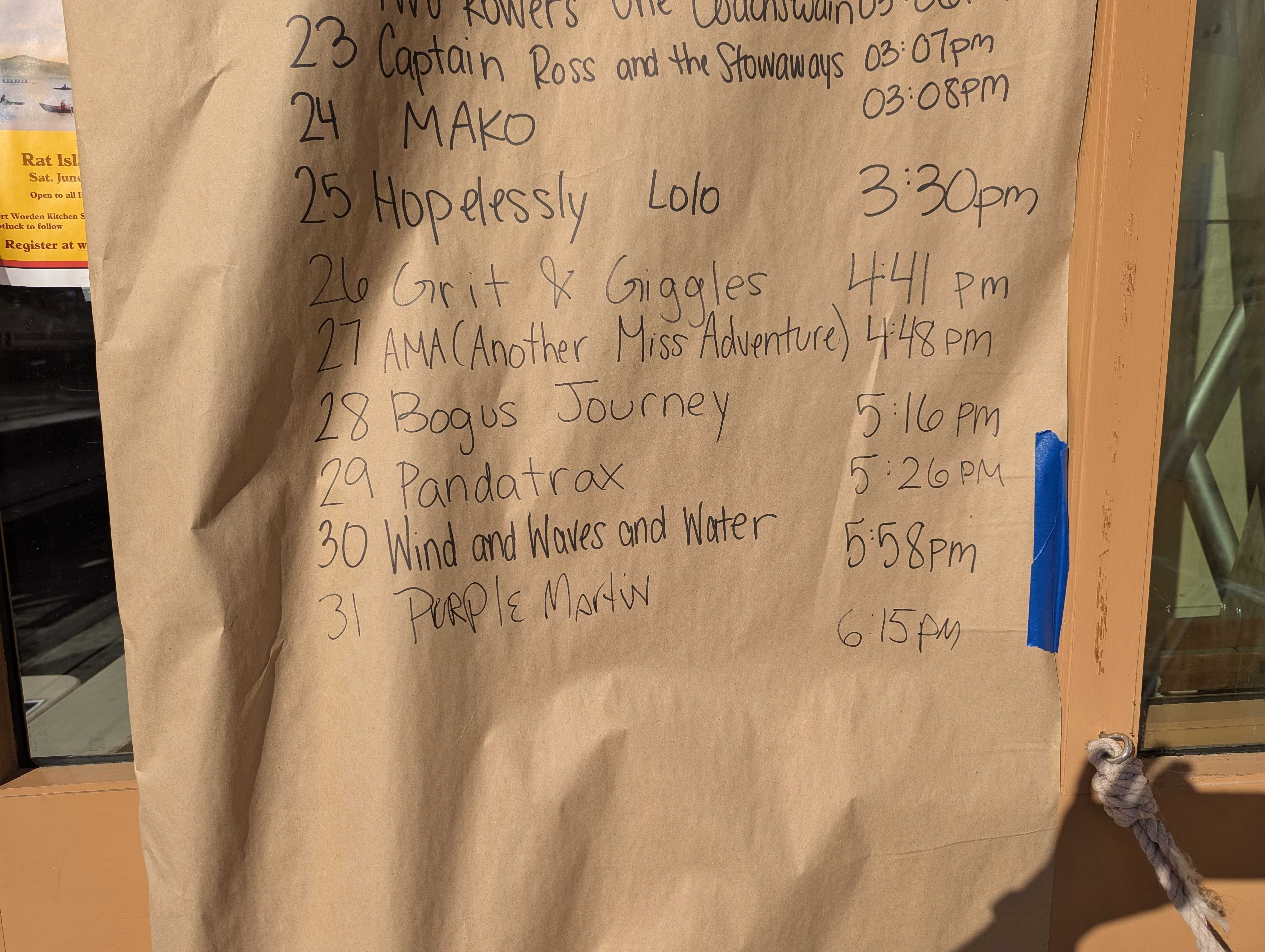
As I passed Lisabeula, I was overjoyed at the fact that there was still light in the sky. I stopped paddling just long enough to take a picture to remind myself that I had accomplished the first of many goals during this race.
Second Ferry Crossing / Blake Island
The paddle up Colvos passage was enjoyable. It was after dusk, but you could see well because of the 3/4 moon as well as the light pollution from Seattle. I enjoyed listening to other teams jamming to their music or just chatting with each other. I had a few conversations with a couple teams as we passed each other.
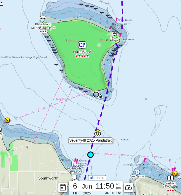
At the end of Colvos passage is the second ferry crossing (Southworth/Vashon/Fauntleroy). Luckily, I had seen it leave Southworth awhile before I got there, so I knew I didn’t have to worry about waiting for it.
The first major stop that most teams plan to stop at is usually Blake Island (Even though some teams do make plans at Lisabeula). Blake is sorta the first quarter mark at almost 22 miles. I arrive at Blake at about 12:18 AM (the 5 hour 18 minute mark). My original plan was to take a short nap at Blake.
I got out and made it up to the bathrooms. When I got back to the beach, I decided I would take off my water boots and water socks off to let my feet dry out a bit. I was also hungry and had run out of my initial stash of fuel. I found a couple bars, but could not for the life of me find the bag that had the majority of my food, which was terribly upsetting. I could not fathom how I would finish the race with the remaining 3 protein bars. As I was sitting there eating my bar, a huge wake hit the beach and started bouncing my boat around on the small rock on shore. I sprinted across the beach with nothing on my feet to rescue my boat from getting a hole torn in it. At this point, I am upset at the fact that I knew better to not leave the boat where I did on top of the missing food. I unpacked my boat and lifted it up further on shore. I was very lucky that things hadn’t turned out worse. At this point, I couldn’t nap, my feet were more soaked and now sandy. I decided to put the boat back in the water and keep paddling. At the time I got back on the water at 1:30 AM (the 6 hour 30 minute mark), a bunch of teams started landing on the beach.
Third and Fourth Ferry Crossings
The next challenges are to pass over two ferry crossings. The Bremerton/Seattle ferry route passes along the south end of Bainbridge Island. Then immediately after that, you pass over the Bainbridge/Seattle route. I was passing over the Bainbridge/Seattle route (25.3 miles) at about 2:49 AM (the 7 hour 49 minute mark). I knew that I didn’t have to worry about these ferries because the last Bremerton crossing was at 12:50 AM leaving Seattle and the last Bainbridge crossing left Seattle at 1:35 AM. Even though I knew this, I was still on high alert. Ferries move extremely fast, much faster than you expect even if you have ridden them before.
Skipping Fay Bainbridge / Saturday Morning Sunrise
The second major stop that a lot of teams plan on is Fay Bainbridge. It is a cute little state park that is at the north end of Bainbridge Island. It is essentially the half way point for the race. An issue with stopping at Fay Bainbridge is that it is a little out of the way.
Just south of Fay Bainbridge Park, there is Skiff Point about three quarters of the way up Bainbridge Island. This is where the shipping channel starts to pull away from Bainbridge Island in order to go up around Point Jefferson. So you have this choice, do you go the longer distance to Fay Bainbridge where you can get out, rest, use bathrooms, etc…. Or do you attempt a long open water crossing and beeline it to Point Jefferson?
I was feeling great when I got to Skiff Point, about 30 miles. It was about 4:08 AM (the 9 hour 08 minute mark) and I decided that it was too soon to stop in Fay Bainbridge… I was going straight for Point Jefferson.
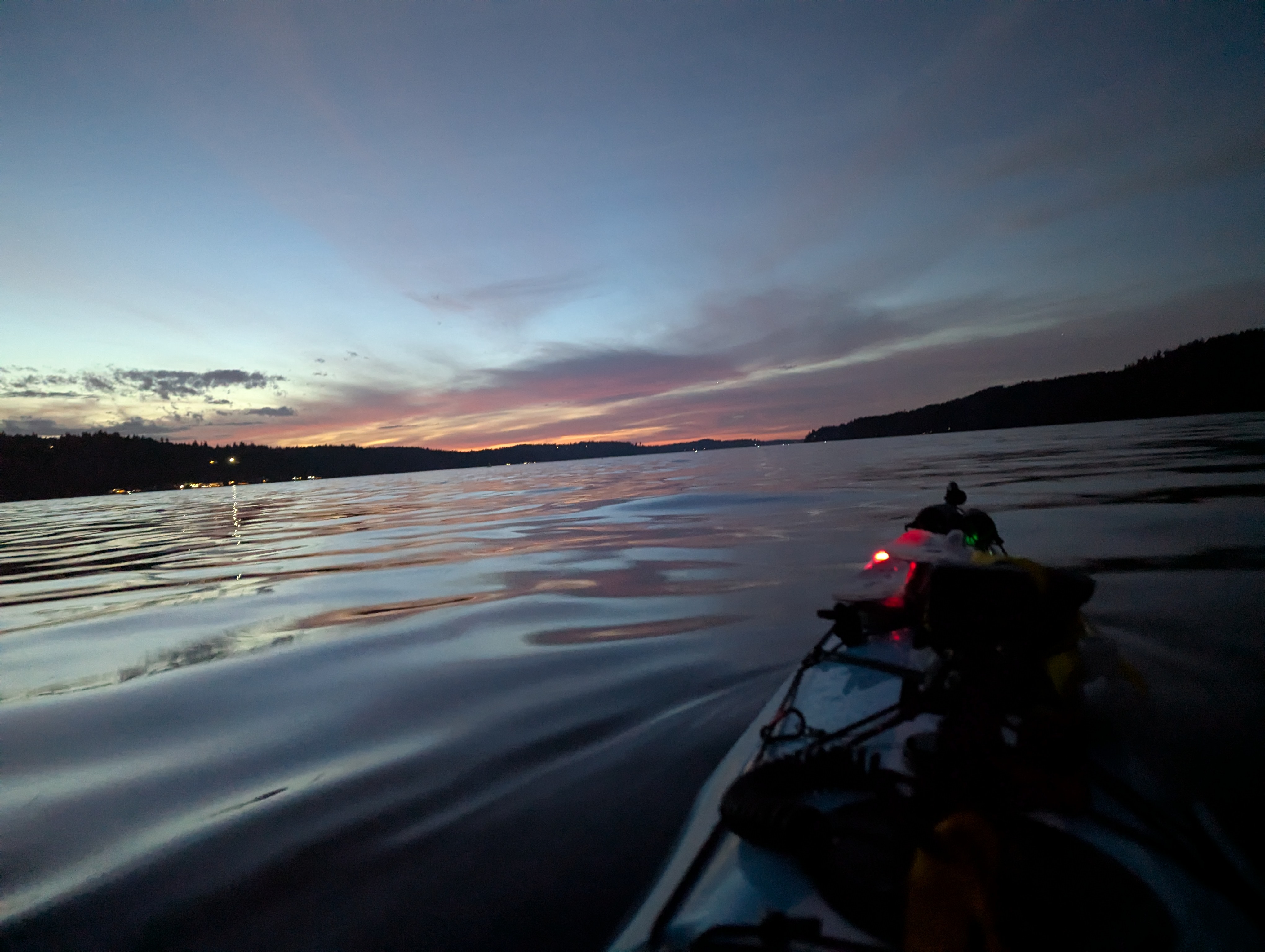
When I got to about the same latitude as Fay Bainbridge a couple huge cruise line ships slowly passed. Awhile after that, their wakes started hitting me. They were slow high wakes that were so much fun to ride over as they passed.
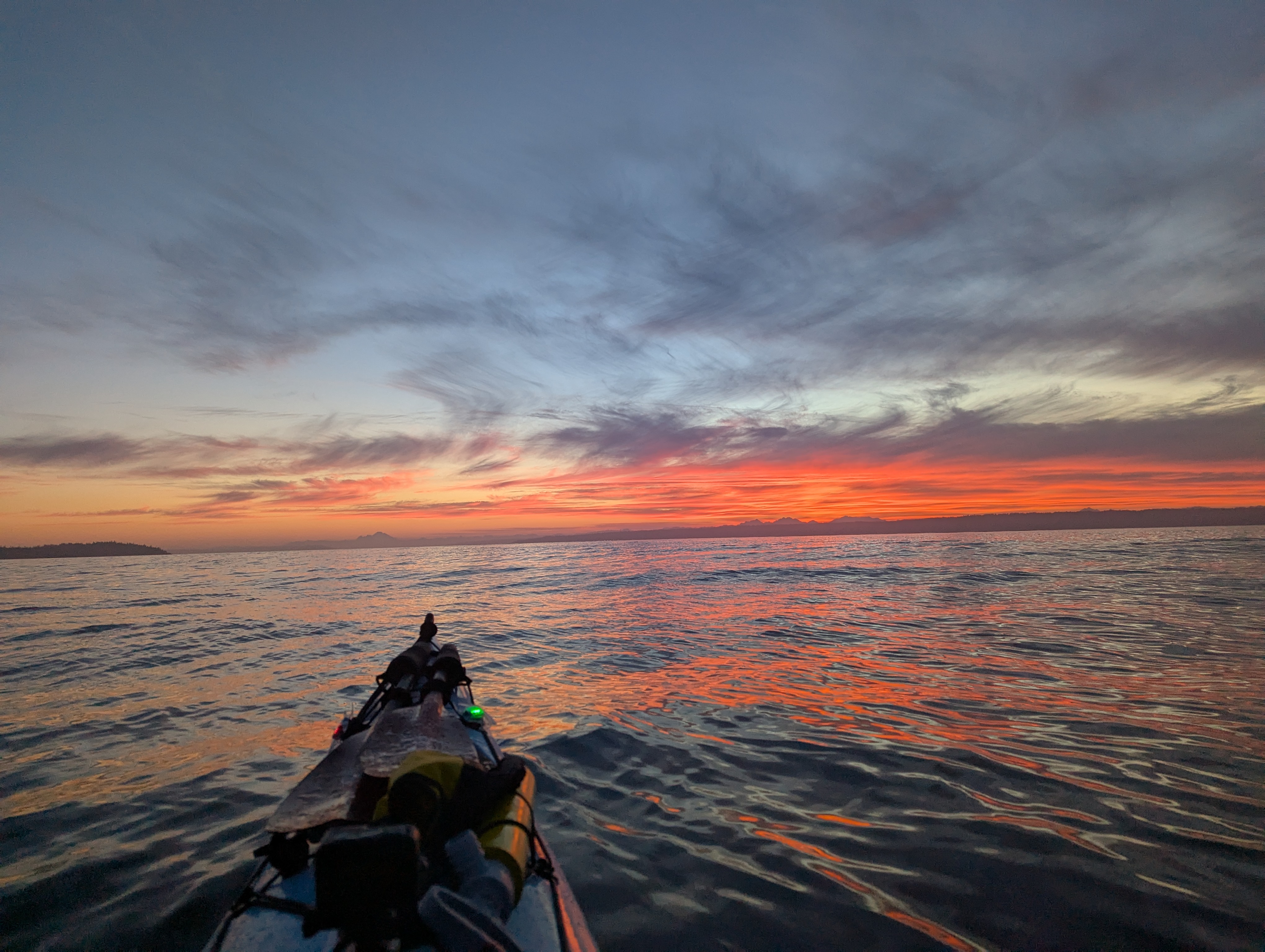
At about this time, the sunrise started to bloom into a magnificent blend of orange and reds, which contrasted so much with the blues from the water and the rest of the sky. This picture doesn’t come close to doing it justice. It was so beautiful, that I forgot the old adage: “Red sky at night, sailors delight; red sky in morning, sailors take warning.” That was at about 5:27 AM (the 10 hour 27 minute mark)
Third Stop / Fifth Ferry Crossing
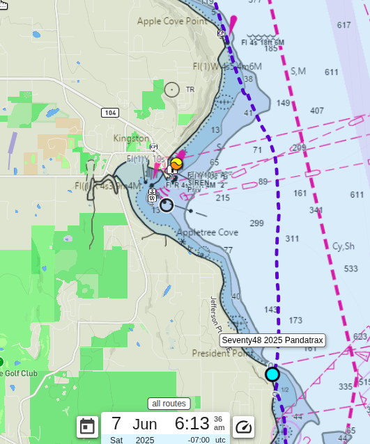
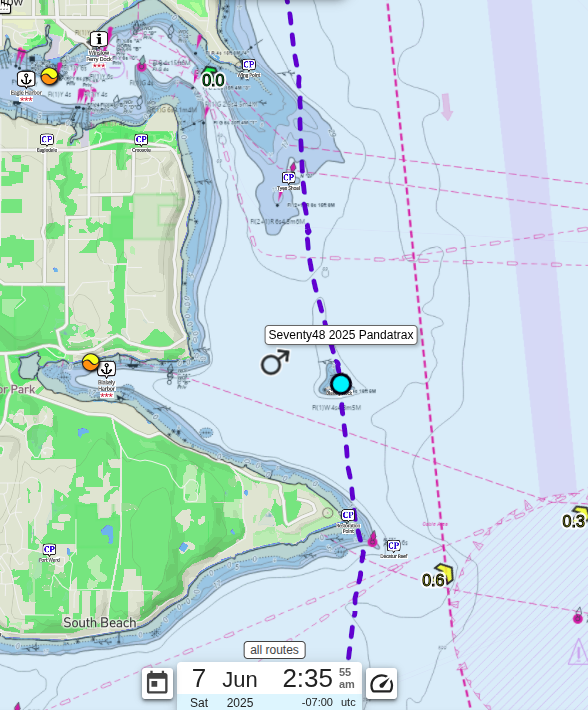
I was getting around Jefferson Point and about to enter the Kingston area. Kingston is where the fifth ferry crossing is. Before dealing with the ferry, I decided to take my third stop. This was like my first stop, but just in reverse, stretch and then turn off my stern and bow lights. It was about 6:07 AM (the 11 hour 7 minute mark) at 37.5 miles.
As I came into Appletree Cove, I noticed that both ferries were docked in Kingston. I then heard the Spokane ferry hail VTS about crossing to Edmond. VTS warned the ferry of a delay. There was tug boat coming down the shipping channel with a gigantic payload. At this point, I was still a ways away from the ferry crossing route, so I pressed on. Before I knew it, the tugboat had passed and the ferry was on its way. It is amazing how long it takes to paddle across Appletree Cove. I was nowhere near the ferry when it crossed my expected path. It took me about an hour and a half to go from President Point, where I stopped and the south end of the Cove, to Apple Cove Point at the north end.
Luckily, I found the rest of my food as I was passing Apple Cove Point. It was in the day hatch behind me. I’m amazed at how much this little hatch holds. It’s the second time I’ve lost something in there.
The Weather Gods Begin Tormenting Me
The next and last big stop that most teams plan is Point No Point or the Hansville Grill, both of which are in Hansville. Approximately halfway between Apple Cove Point and Point No Point, there is Eglon. As I was approaching Eglon (44.5 miles in) at approximately 8:27 AM (the 11 hour 27 minute mark), the expected headwind started to pick up. Up until this point, the winds were not too bad, if there was wind at all. By the time I made it to Pilot Point, I knew the weather gods had started their fun. I passed a couple row boats that were struggling with the wind and I was not too please either. The sad thing is that I knew what was coming once I rounded Point No Point. I had played this game before.
Point No Point/Hansville
I rounded Point No Point at around 9:30 AM (the 14 hour 30 minute mark), which is about 48 miles into the race. At this point, I have been fighting the winds for an hour and dreading to see all the white caps as I rounded the point. To my surprise, the waters in Hansville were just a bit bumpy, but nothing to worry about. I was super confused, but was happy for the break. I made a push to take a break at the Hansville grill.
As I was getting closer, I saw my love waiting for me on the beach. I can’t tell you how great it was to see her right then. I was feeling beat up from the wind and the hours in the boat. She gave me the best hug in the world - seriously, it was like a power-up in a video game.
I was smarter this time and unpacked my kayak and lifted it up onto the beach. The beaches here get hammered by the wakes of the gigantic container ships. I wasn’t about to repeat the mistake I made at Blake. It was around 9:50 AM (the 14 hour 50 minute mark) at this point (no pun intended) at 49.3 miles.
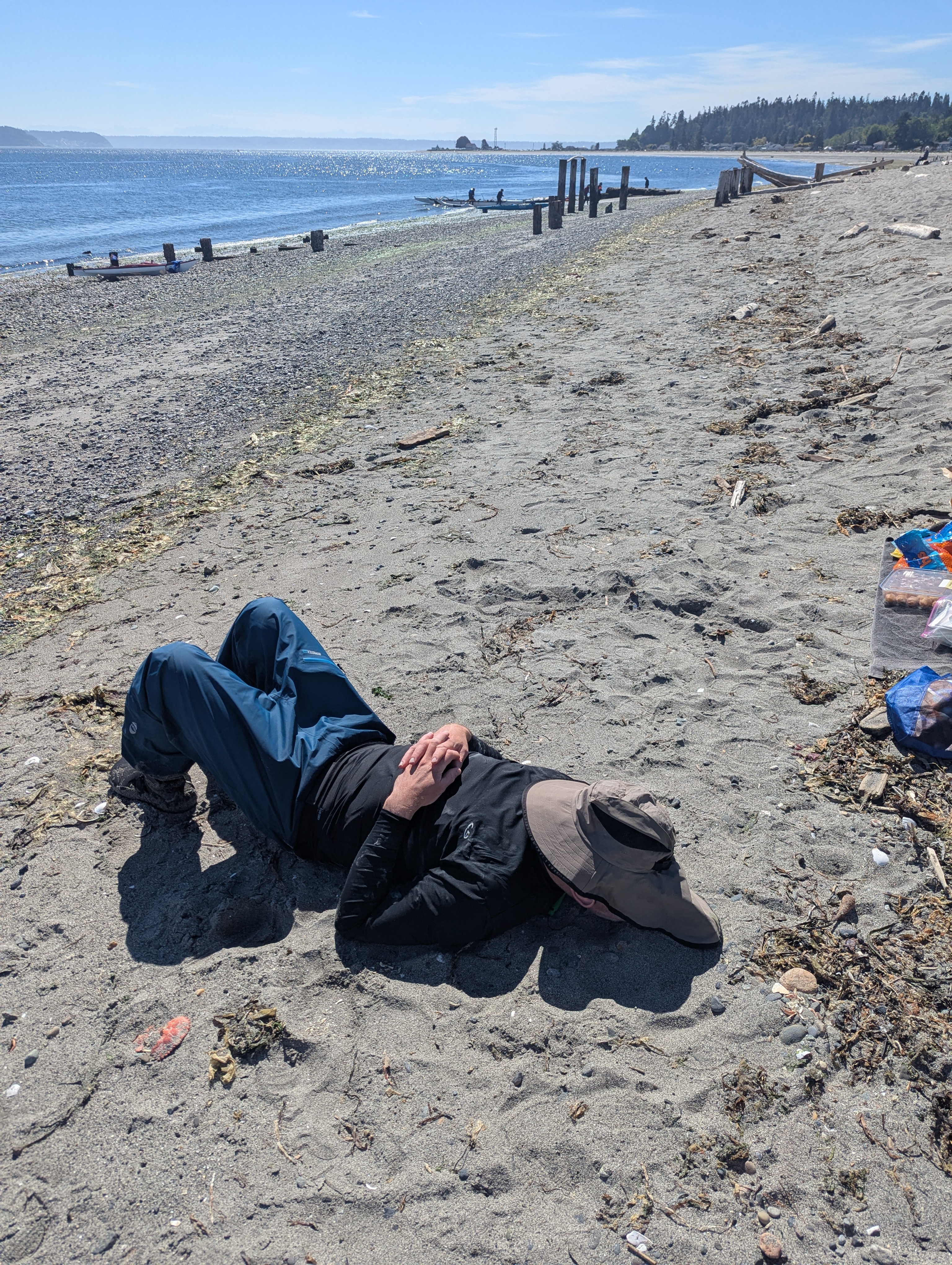
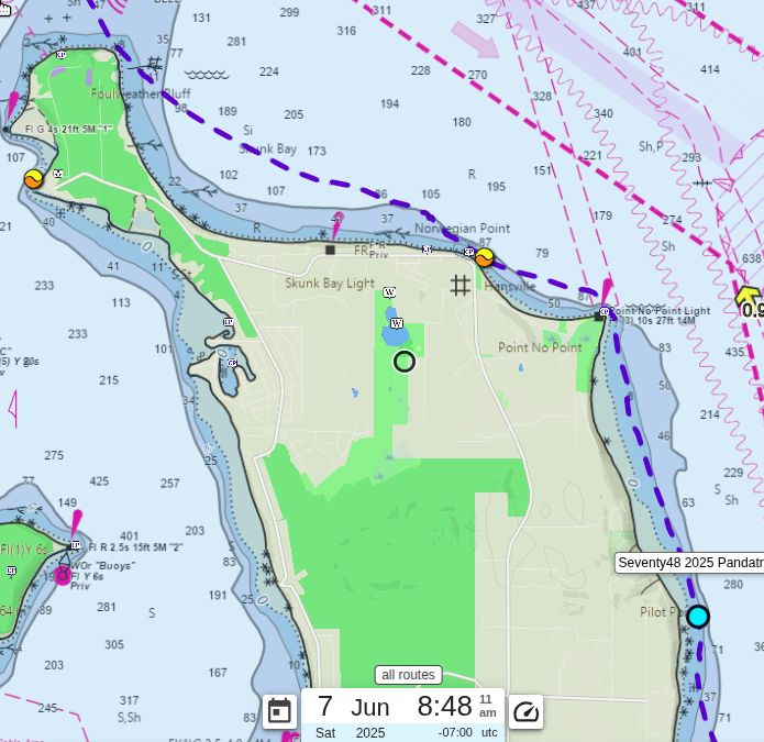
My original plan was to take my second nap here at Hansville. I was a bit worried about the weather, but we thought it would be best to try for a nap. I lay there for about 15 minutes, but just couldn’t fall asleep. I am one of those people who can just shut my eyes and be asleep, so I knew after trying for 15 minutes that it wasn’t going to happen. I’m glad I tried because it gave my body a break from sitting. When I got up, I saw that the winds had caught up to me. Skunk bay between Hansville and Foul Weather Bluff was all white caps.
I loaded my kayak back up, gave Mary a kiss goodbye and headed back out onto the water and into the winds by 10:30 AM (the 15 hour 30 minute mark).
Screaming At the Weather Gods
As I crossed Skunk Bay to get to Foul Weather Bluff, it felt like I was in a washing machine. Waves were hitting me from all angles and were very unpredictable. When I got to the Bluff at 52.4 miles, it was 11:55 AM (the 16 hour 55 minute mark). It had taken me almost an hour and a half to go 3 miles. The gods were having hysterical fits overjoyed at watching me struggle.
At this point, my plan was to cross the mouth of the Hood Canal to Mats Mats Bay and go up the coast to the Cut (our second checkpoint). I could only see two other teams in front of me. Instead of doing the same as my plan, both teams started going straight for Marrowstone.
The Mats Mats Bay route includes a 3 mile open water crossing across the mouth of the Hood Canal, but is around a mile longer route.
The Marrowstone Island route includes a 6 mile open water crossing across not only the mouth of the Hood Canal, but also Oak Bay.
At this point, the tide was coming in at almost a knot, but the winds seemed to be coming directly from the North. After seeing these team heading for Marrowstone, I convinced myself that I would follow, because going across to Marrowstone at a slight angle from the headwind might be slightly better than fighting the headwind dead on up the coast.
I was about a quarter of my way up to Marrowstone when the other two teams turned left towards the shore. At this point, I was committed to my decision and was not diverging from the plan.
When I started entering the north end of Oak Bay, the wind became relentless. I was exhausted, cursing and yelling at the winds and felt like I wasn’t moving forward. I finally made it to shore, near the cut at about 3:03 PM (the 20 hour 3 minute mark) at 60.4 miles. It had been 3 hours and 8 minutes since I left Foul Weather Bluff fighting the winds, waves and current.
Second Checkpoint / Free Donut
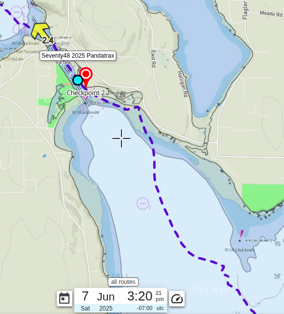
When I got close to the shore just east of the Cut, I had a bit of a reprieve from the wind. My body was hurting and I thought about just going ashore and taking a break, but then I look at the current going through the Cut. It was 2.2 knots going north. Sadly, I didn’t look to see which way the tide was going, because it was going in a favorable direction. As soon as I saw the current speed, I decided that I would get through the cut then and rest on the other side. If things were any bit like two years ago, Port Townsend Bay would be like Skunk Bay hours before.
As I approached the Cut, there were several groups of people cheering me on. I appreciated this so much that I almost forgot about all the yelling I had done at the wind for the past few hours.
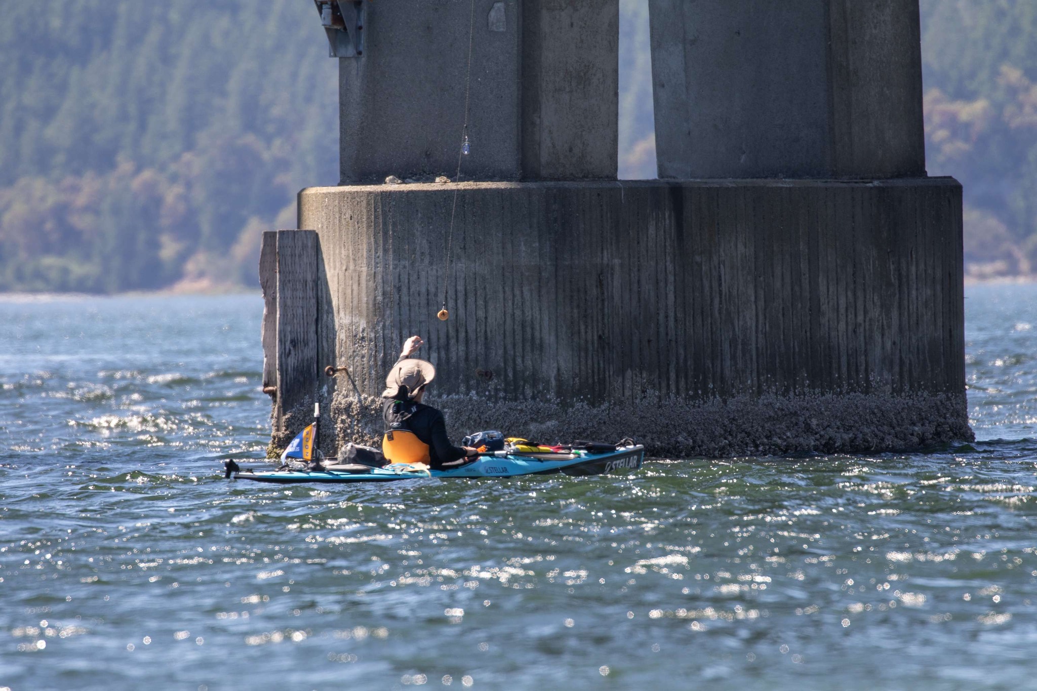
Even with the current in my favor, passing through the cut was difficult. The Cut acts like a funnel for the wind and it was just terrible. I finally got to the bridge where the infamous donut drop happens. I was so happy to get a donut while a huge group cheered me on from the shore. Never has a donut tasted so good. It was 3:26 PM (the 20 hour 26 minute mark).
Not Disturbing the Gunboats
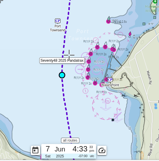
As you enter Port Townsend Bay, you have Port Hadlock on your left and Indian Island on your right. Indian Island is a major U.S. Navy munitions handling facility. There is a certain distance that you must maintain from the island, unless you want to be visited by a big gun boat.
As I entered the Bay, my plan was to cut directly over to Port Hadlock and battle the wind up the coast. To my surprise there was a wind hitting me from the north, but it was nothing like what I had just experienced. I decided to instead go up the middle of the bay, keeping my distance from Indian Island.
The Last Ferry Crossing / The Finish
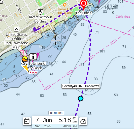
After passing the island, I started making my way towards the finish line. The last hurdle is the sixth and last ferry crossing. I saw the ferry coming in as I was passing the island. As I approached the ferry route, I thought that I was home free. At the last second, the ferry blew its horn indicating that it was leaving port, I had to stop and wait for it to pass. Luckily, it wasn’t too long.
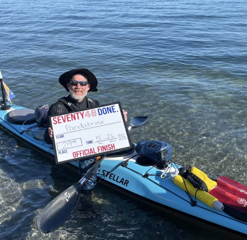
I am proud to say I finished at 5:26 PM. That’s 22 hours and 26 minutes of paddling over 67.7 miles, battling wind, waves, and my own sanity. I’m so happy!
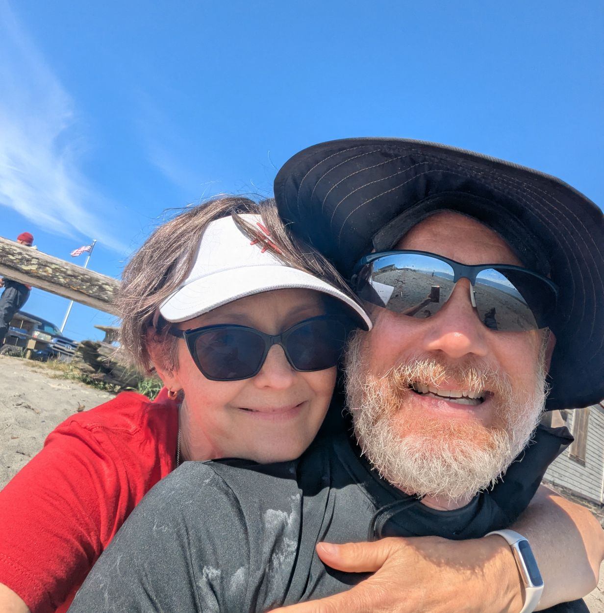
One of the best things about crossing the finish was seeing my beautiful wife, Mary, waiting for me. She’s been my rock through all the training, the planning, and the emotional rollercoaster that is Seventy48.
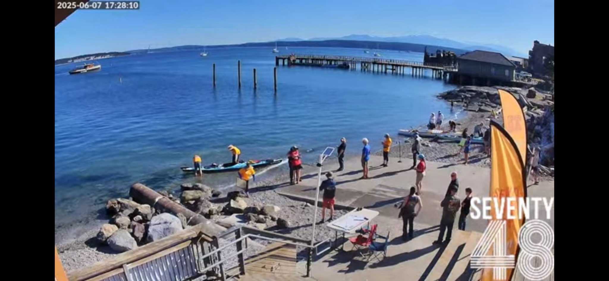
Once I was helped out of the boat (legs: not working), Mary gave me the biggest and best hug. She’s been an enormous help - supporting my training, listening to endless strategy talk, and being the best emotional support. I definitely couldn’t have done this without her. Love you soooo much, Mary! (And yes, that hug was as good as it looks, if you can see us… We’re so small.)
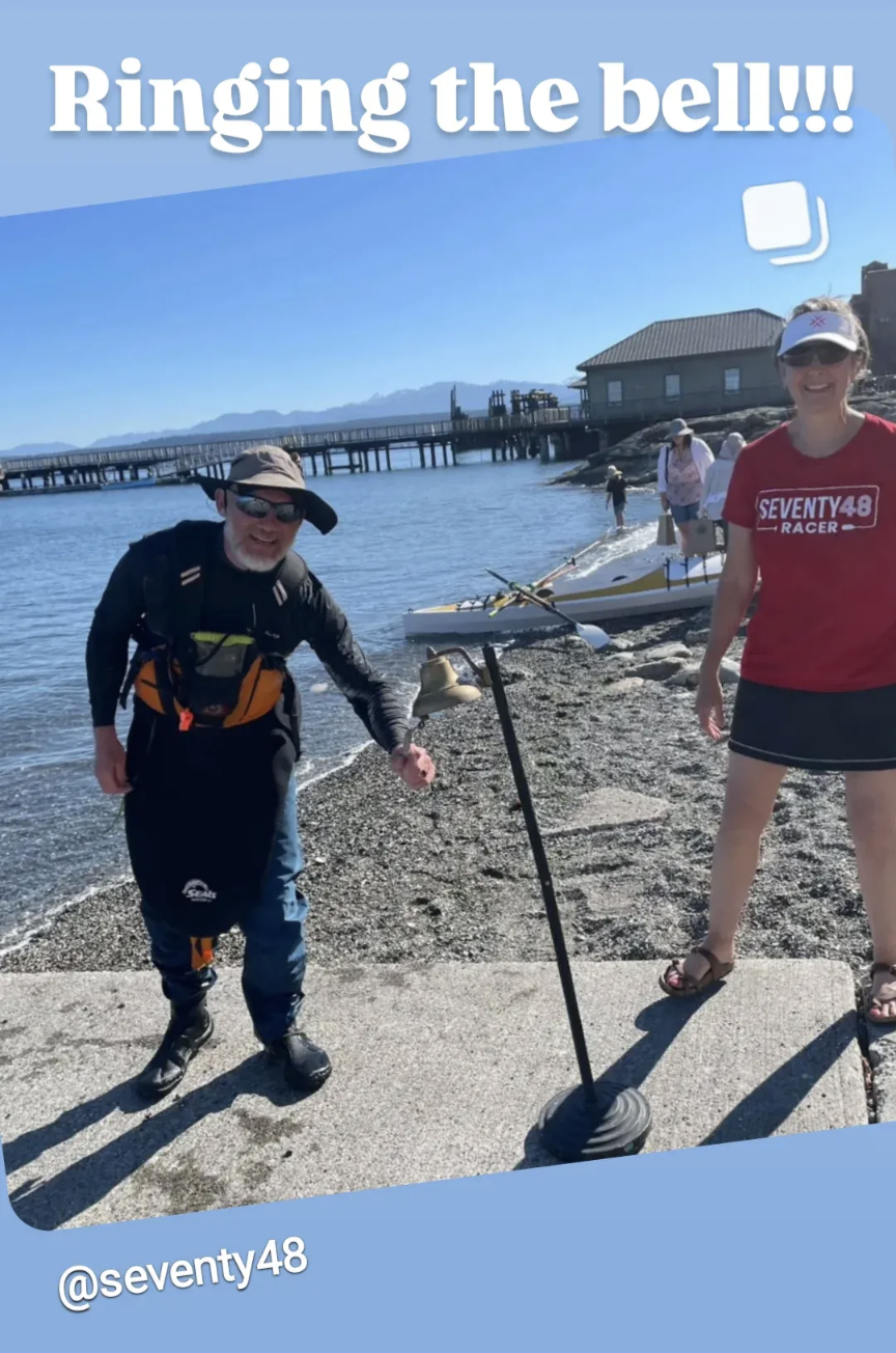
Luckily, I was able to stumble up to the bell and ring it without falling on my face. Mary took a picture of my finishing place and time, something I completely forgot about.
Our friends, Mike and Lorie, were there at the finish as well. They’ve been there for the past two years, helping pack things up and put the boat on the car. I can’t thank them enough for the support!
Crashing after the race
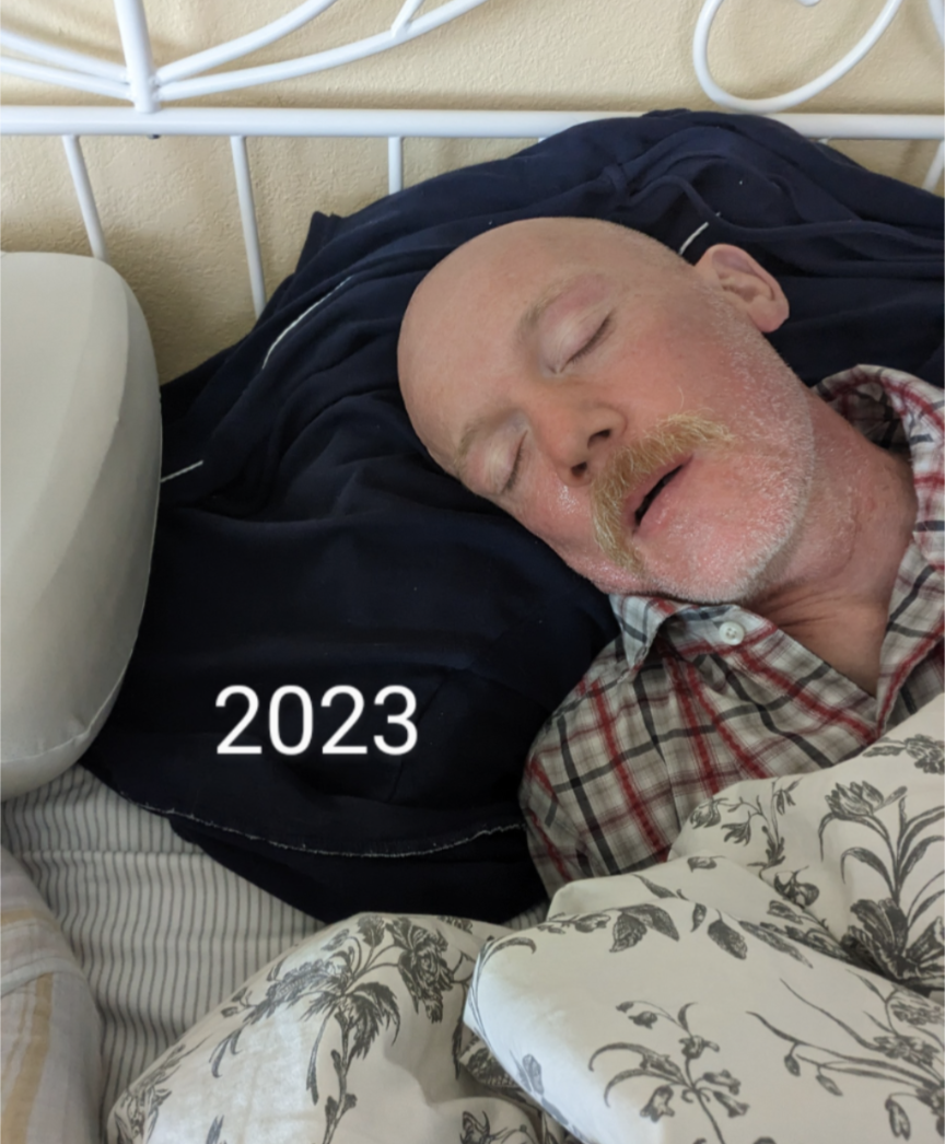
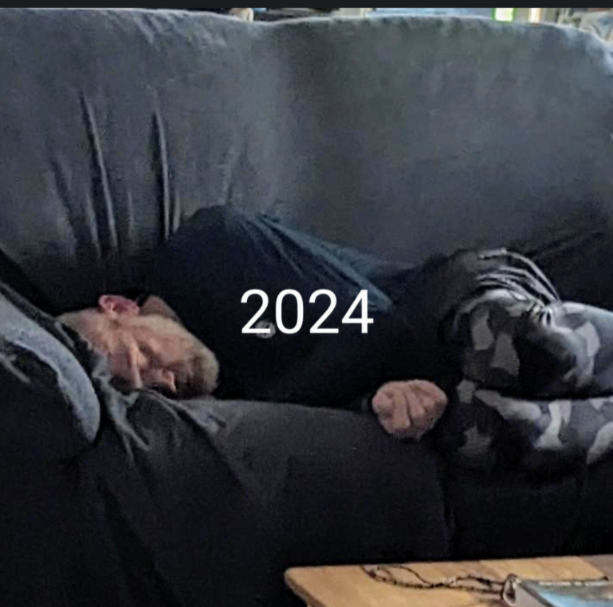
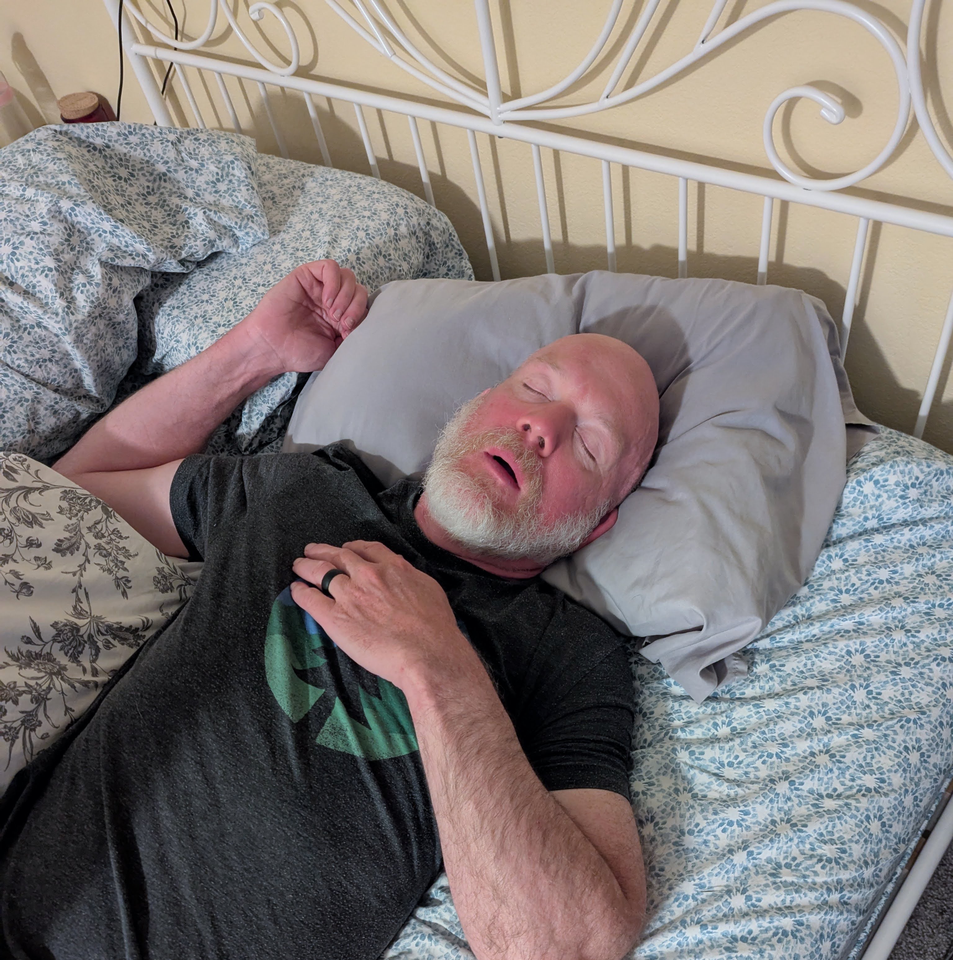
After the past two races, I’ve completely crashed when I got home and this year was no different. Mary made sure to commemorate this sub-event. (Thanks, Mary. lolol)
Neck Tie Event
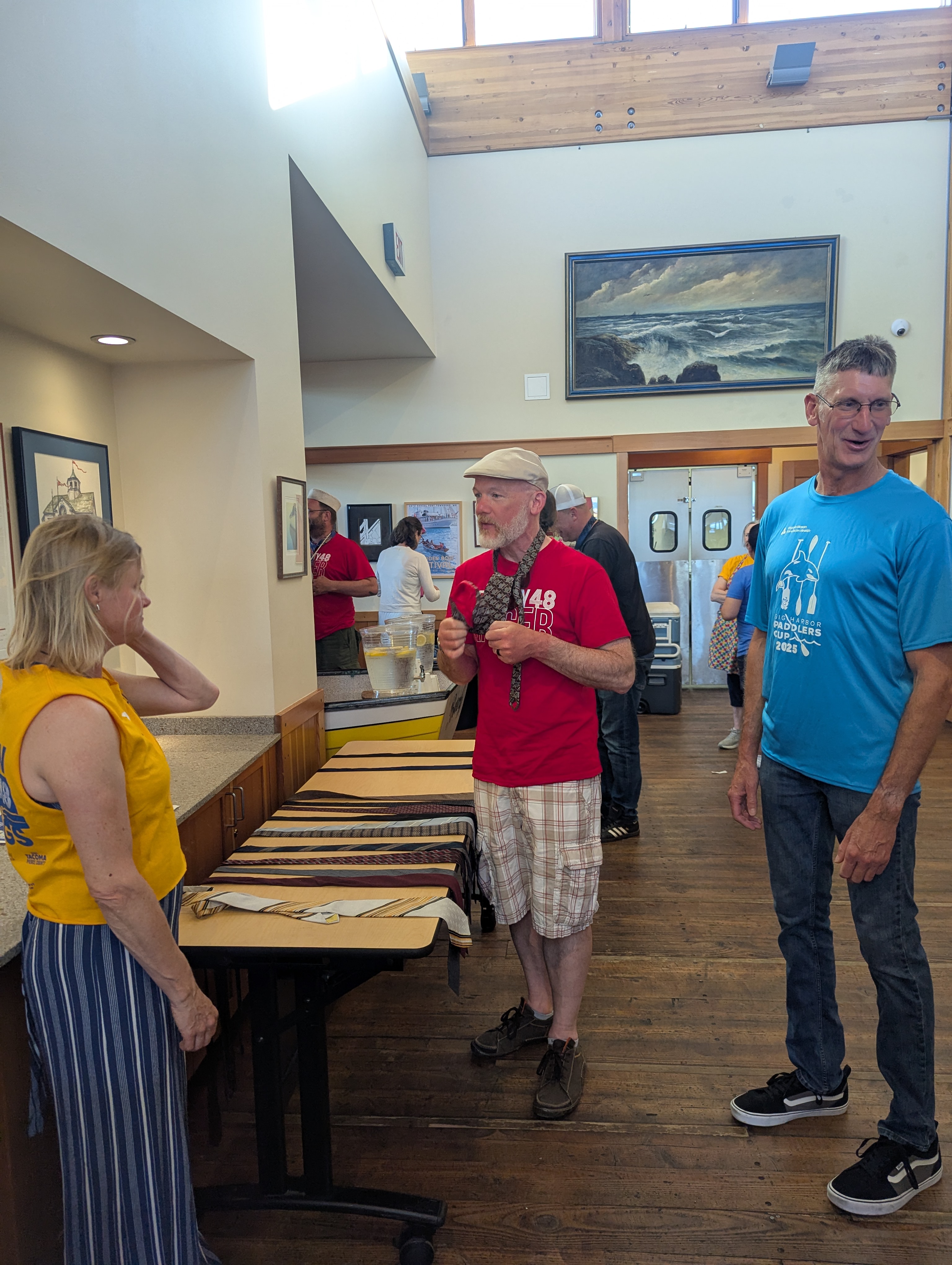
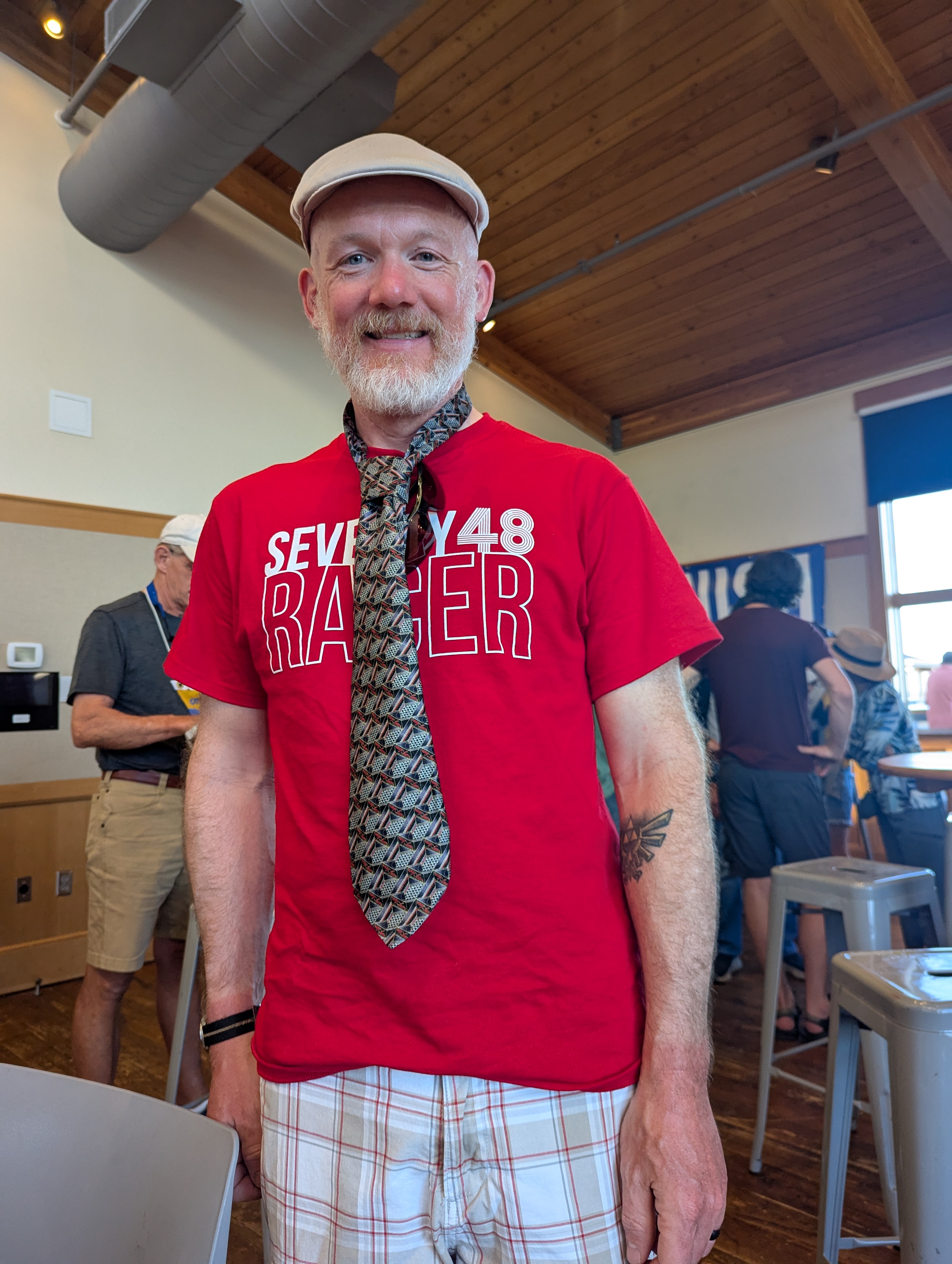
The neck-tie affair is a quirky tradition to celebrate all the racers. Here’s how it works: everyone gets a necktie, but only those who finish the race get to keep theirs intact. Didn’t make it to the end? The scissors come out, and your tie gets snipped - exactly at the spot on the race map where you called it quits. It’s equal parts hilarious and humbling. I’m proud to say my tie survived the ceremony unscathed - no scissors anywhere near it this year!
During the race, I had the pleasure of paddling alongside Jim from “Team Wind and Waves and Water” for a stretch. We bonded over our mutual struggle with the relentless wind - misery really does love company! At the neck-tie affair, Jim joined Mary and me for a bit, and we swapped stories (and maybe a few groans) about the wind trials we survived together. It’s always better to laugh about it after the fact, especially when both of your ties survived the ceremony!
Final Stats / My Thanks
| Teams that started | 104 |
| Teams that finished | 77 |
| My finish time | 22 hrs 26 min |
| My place overall | 29th |
| Total # of kayaks | 31 |
| My place in kayaks | 2nd |
| My place in single kayaks | 1st |
Huge thanks to everyone who organized and volunteered at this event. As always, it’s an amazing experience for everyone involved. Special shoutout to Jesse and Verity!
And, as mentioned above, thank you to my wife, Mary. You are amazing, and I don’t know how I could have finished without your support this year. Love you tons!
If you made it this far, you deserve a donut too!