TL;DR
Four races in, and I still bury the results at the bottom like some kind of suspense novelist. If you want the quick version: scroll down, grab the stats, feel good on my behalf. If you want the full tale of wind, ferries, and a free donut, read on. :)
What is this craziness?
Welcome back to my annual tradition of doing something completely unreasonable and then writing a very long blog post about it.
This year I took on the 8th annual Seventy48, my fourth year in a row. I have now paddled this course enough times that I dream about ferry crossings. Not in a fun way.
For any newcomers: Seventy48 is a human-powered boat race from Tacoma, WA to Port Townsend, WA. About 70 miles, 48-hour time limit. No engines. Just paddles, questionable snack choices, and an alarming amount of optimism.
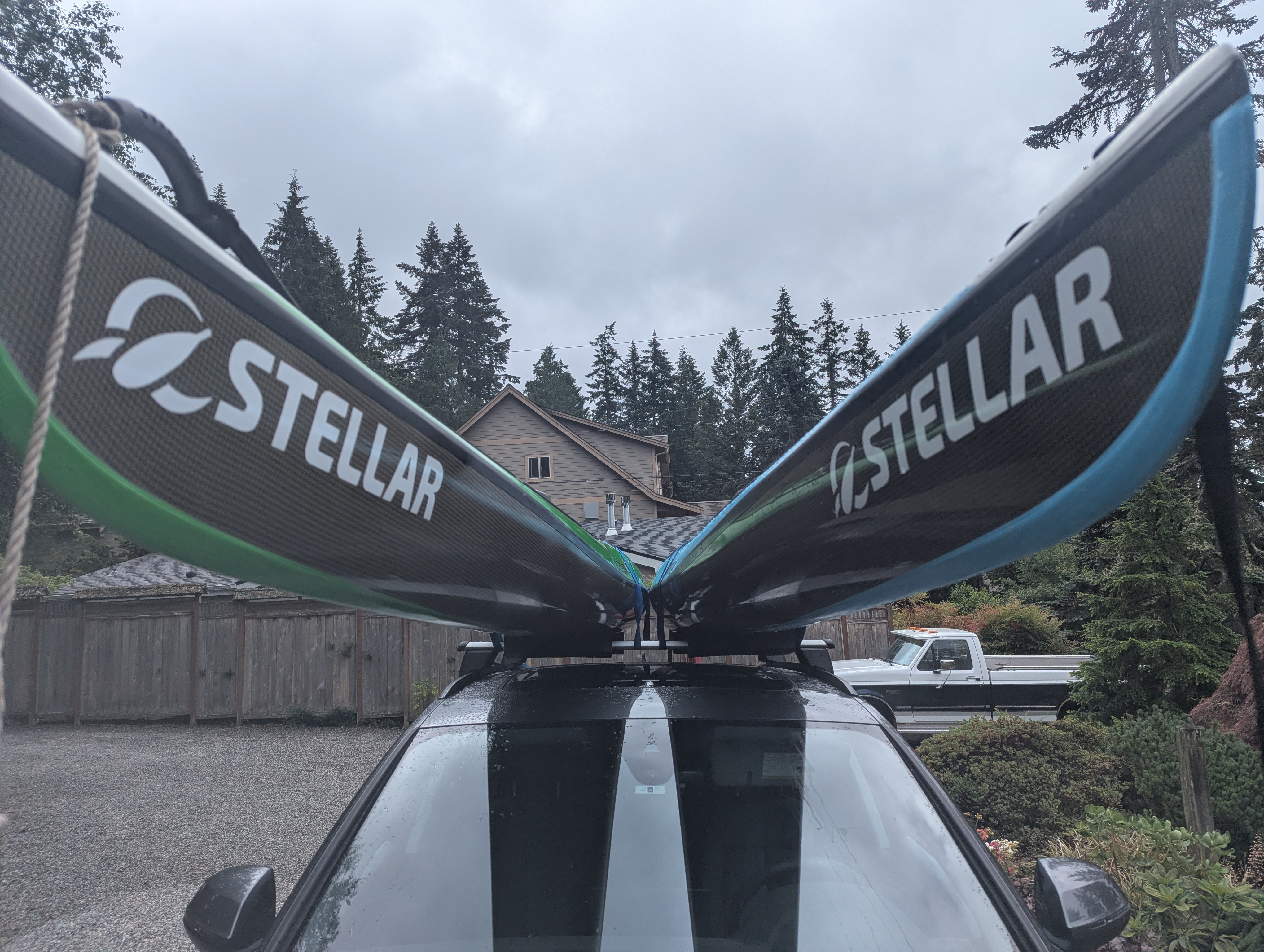
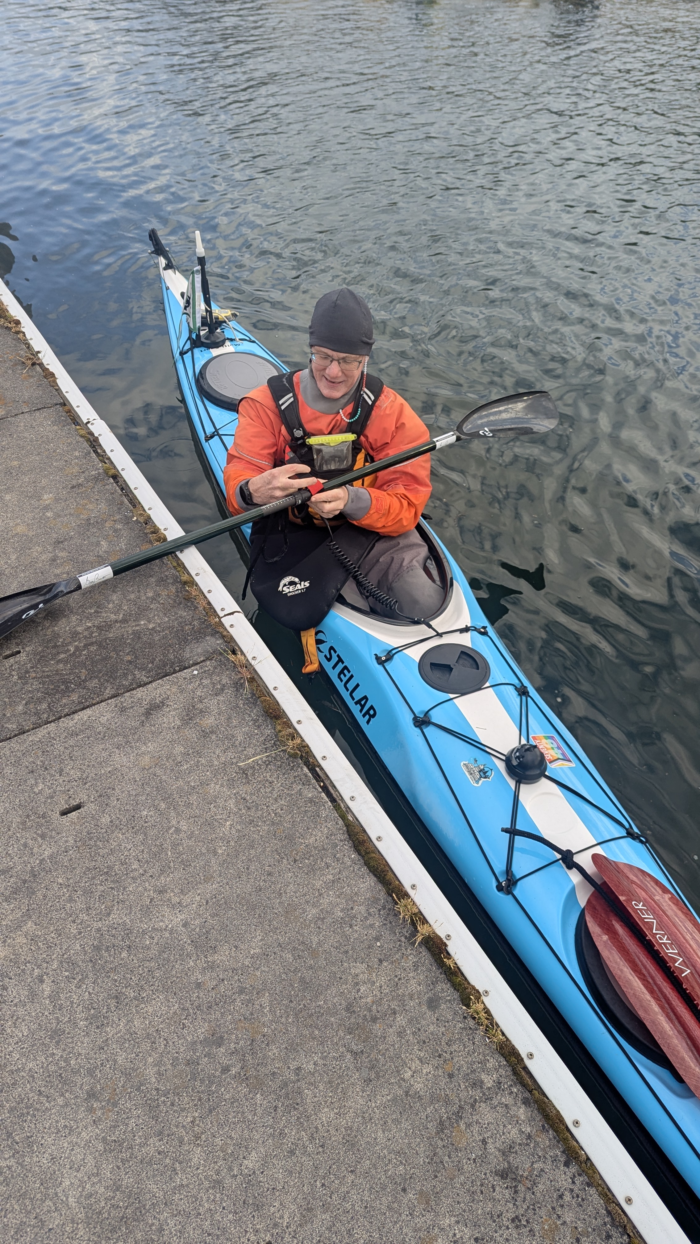
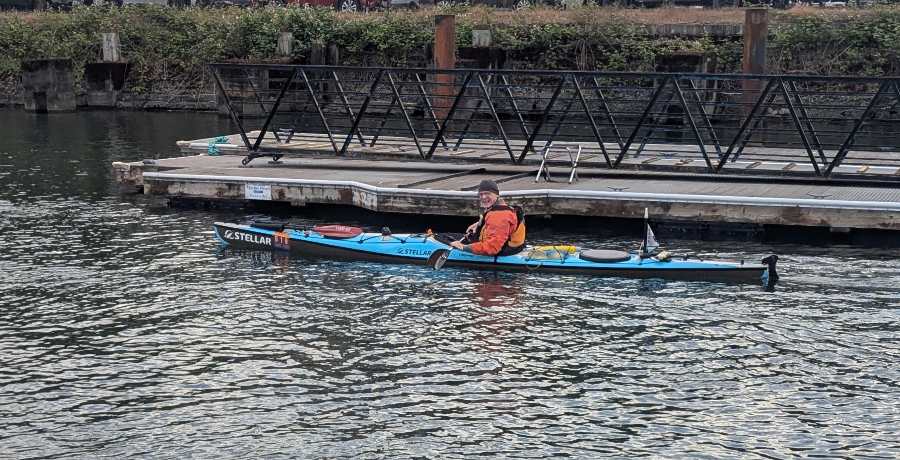
I paddled my Stellar S18 Expedition G2 for the second consecutive Seventy48. We have an agreement: I point it north, it handles the rest. This year, 133 teams (over 200 people!) started. Here’s the boat breakdown:
| Rowboats | 50 |
| Kayaks | 49 |
| Normal Canoes | 12 |
| SUPs | 9 |
| Surfskis | 7 |
| Outrigger Canoes | 7 |
| Pedal Boats | 2 |
| Prone Paddleboards | 2 |
| Sailboat | 1 |
Yes, that’s a sailboat. No sails, though — it was rigged with oars, a pedal drive, and whatever else keeps the entry legal. This is a human-powered race, after all.
Pre Race
This year I came into the race more prepared than ever: regular visits to my CrossFit gym, hundreds of kilometers on the indoor rowing machine (ergometer for those in the know), and more miles on the water than I can count. Oh, and I shaved off my beard to increase aerodynamics. Every little bit helps.
In the weeks leading up to the race, I became obsessed with the weather forecast. And I mean obsessed. Every morning, a different story. Sunny and calm one day, winds out of the north the next. For a race like this, the weather is the true randomizer. You can study the tides and plan exactly how the currents will work in your favor at each stage of the course. You can map out your pit stops down to the mile. But the weather? The weather answers to nobody. Waves can flip every carefully laid plan upside down in a matter of hours, and there is nothing you can do about it except paddle and hope you made the right call.
Jim from Team Wind and Waves and Water has been one of my main training partners leading up to this race. We put in a lot of miles together on the water, and he was kind enough to give me a ride down to Tacoma for the start. Here’s where it gets fun: Jim had borrowed my kayak for a week earlier in the training season, fell completely in love with it, and went out and bought the exact same boat. So there we were, two Stellar S18EXPG2s strapped to his car, heading to the starting line.
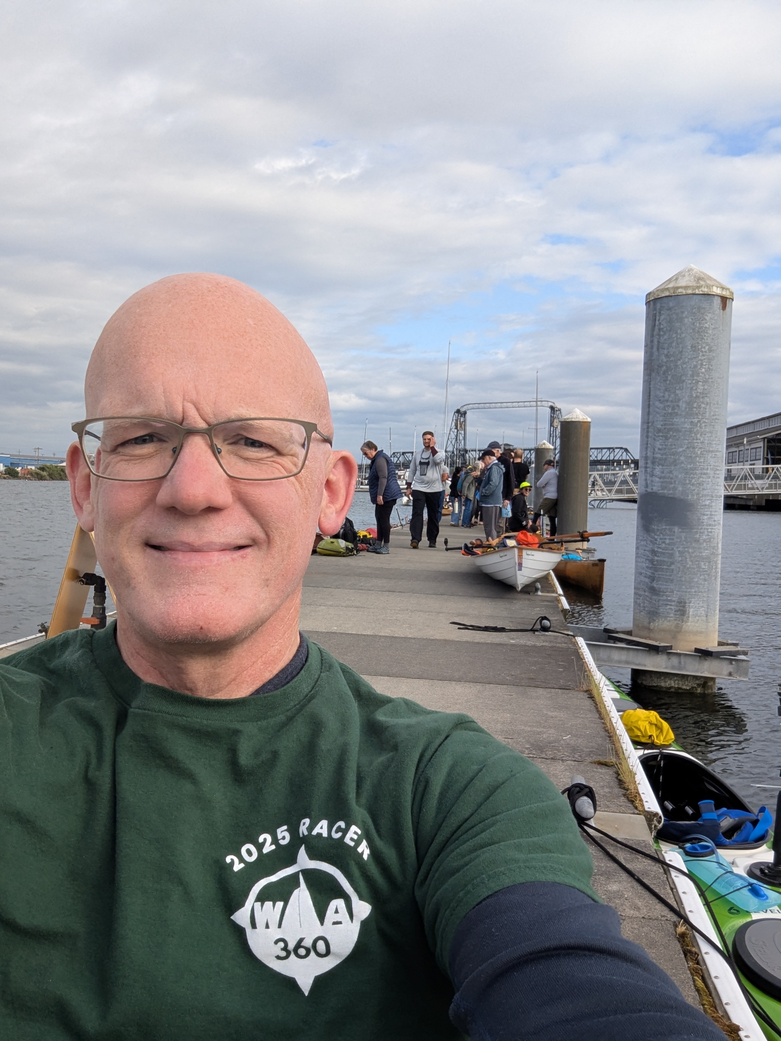
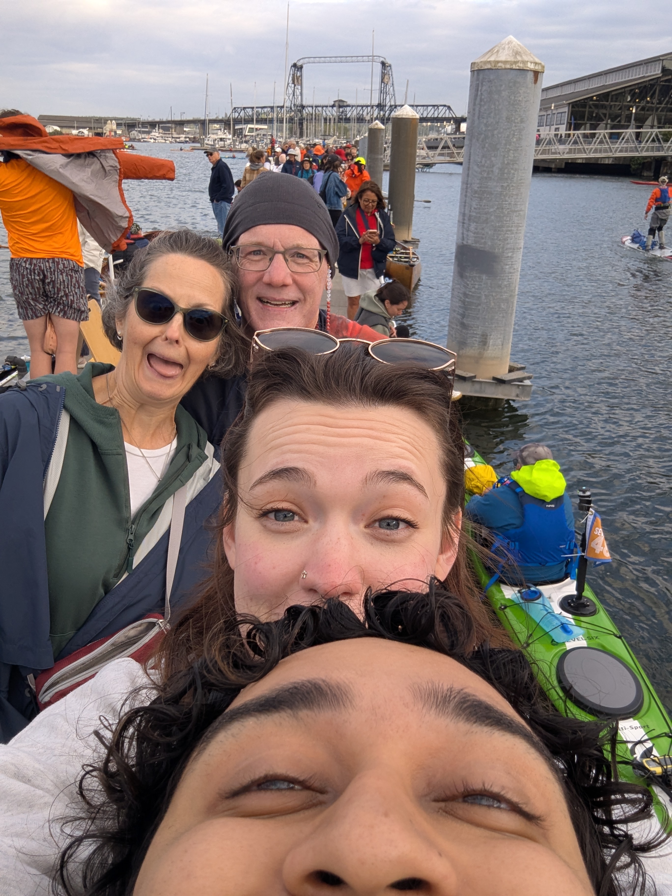
We rolled in around 2 PM and immediately got to work claiming dock space and prepping our boats. I checked in, got my race shirt and tracker, and found out my boat number: 19. I’ll take it!
Mary (my amazing wife), Brenna (my daughter), and Joseph (her boyfriend) made the trip out to see me off. Having your people on the dock before a big race is something I will never take for granted.
If you read last year’s post, you may remember that I swapped my drysuit for a wetsuit. Bold move. Terrible outcome. My feet got wet early and stayed wet for the entire race. I’m talking 22-plus hours of soggy, unhappy feet. So this year I made the executive decision to go back to the drysuit. Some lessons you only need to learn once.
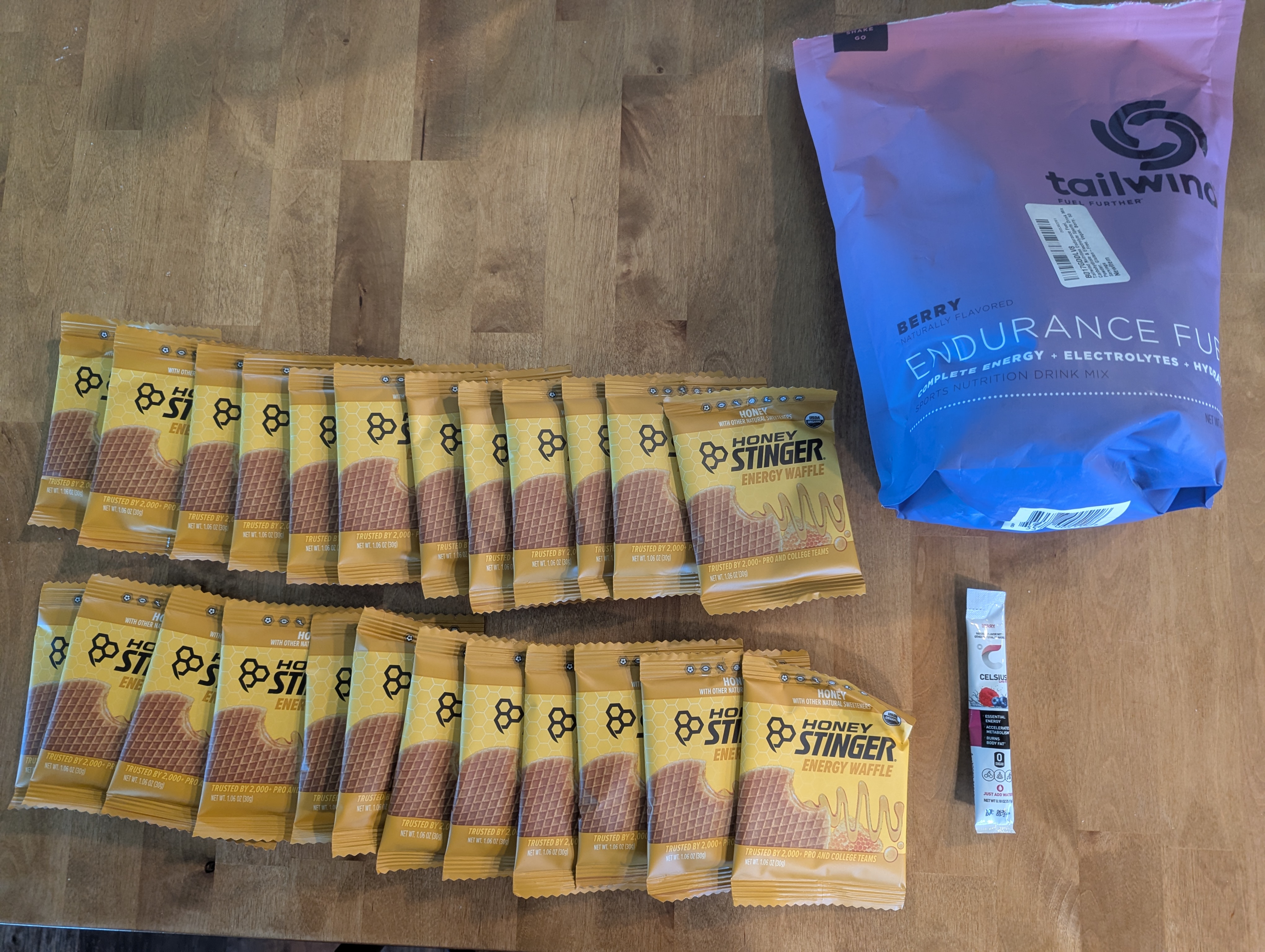
For fuel, I kept it simple: Honey Stingers and water mixed with Tailwind. I packed 24 Honey Stingers, roughly one per hour I expected to be out there, with a couple extras just in case things went sideways. I also brought 8 liters of Tailwind/water to keep the engine running.
A big part of dialing in the fuel plan was a care package that arrived from Trish Howison, Mary’s cousin. Trish raced the Seventy48 in 2024, and last year she paddled and finished the WA360 alongside me. She sent a box of extra fuel that I used on a couple of practice paddles right before the race. It was exactly what I needed to make sure the nutrition strategy was locked in before race day.
Beyond that, I kept the gear list ruthlessly short, mostly emergency essentials. Lighter boat, faster boat. That was the theory, anyway.
The Start
Seven PM. On purpose. The Seventy48 kicks off at the Foss Waterway Seaport in Tacoma, right as the rest of the world is sitting down to dinner. Four years in and I still can’t fully explain why that start time feels like a good idea. And yet, there I was.
My goal was the same as last year: sub-20 hours. Spoiler: I crushed it.
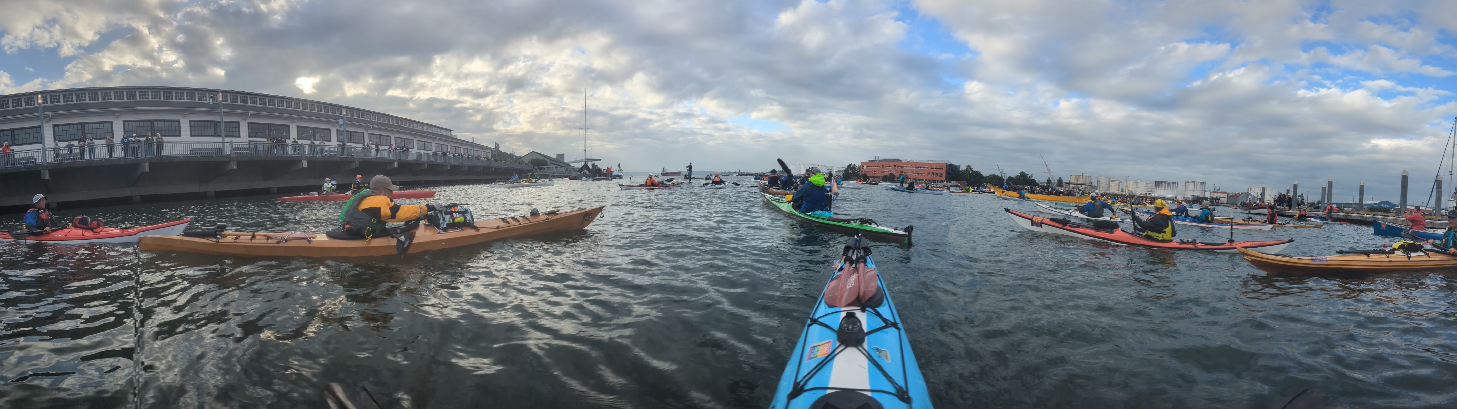
There was already a bit of wind at the starting line, just enough to keep nudging me back away from it while I was trying to get a panoramic shot. The water was absolutely packed with boats of every imaginable type, and the dock and shoreline were lined with spectators. It was the kind of scene that gives you a little jolt of energy right when you need it.

When the flags switched from red to green, everyone surged forward. I held back a little, deliberately. I knew exactly how much paddling was ahead of me, and blowing up in the first mile to look fast is not a strategy I am interested in. Slow is smooth, smooth is fast, and all that.
As we paddled out of the Foss Waterway, I scanned the crowd looking for Mary, Brenna, and Joseph. I never spotted them. I was a little sad to have missed them, but honestly there were so many people it would have been hard to find anyone. I kept paddling, and as I cleared the waterway the headwind started to pick up. Of course it did.
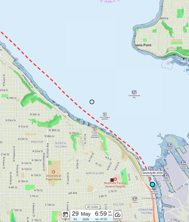
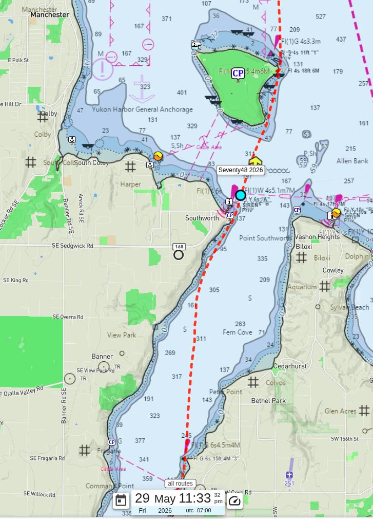
Owen Beach / First Ferry Crossing / Waypoint 1
The first of two waypoints is at Owen Beach, about 5.9 miles in. Getting there requires crossing the Point Defiance ferry route, but I got lucky: the Vashon ferry was sitting in the dock on the other side when I crossed the ferry route, so I didn’t have to break stride waiting for it.
As I approached Owen Beach, the waves were gradually building. I could already see the whitecaps waiting for me across Commencement Bay, right where I’d need to cross into Colvos Passage. Not exactly a welcoming sight.
At the waypoint, there was a crowd on the beach cheering everyone on, and I exchanged a few words with the folks on the mark boat. I passed at around 8:10 PM, about 5 minutes faster than last year. I’ll take every minute I can get.
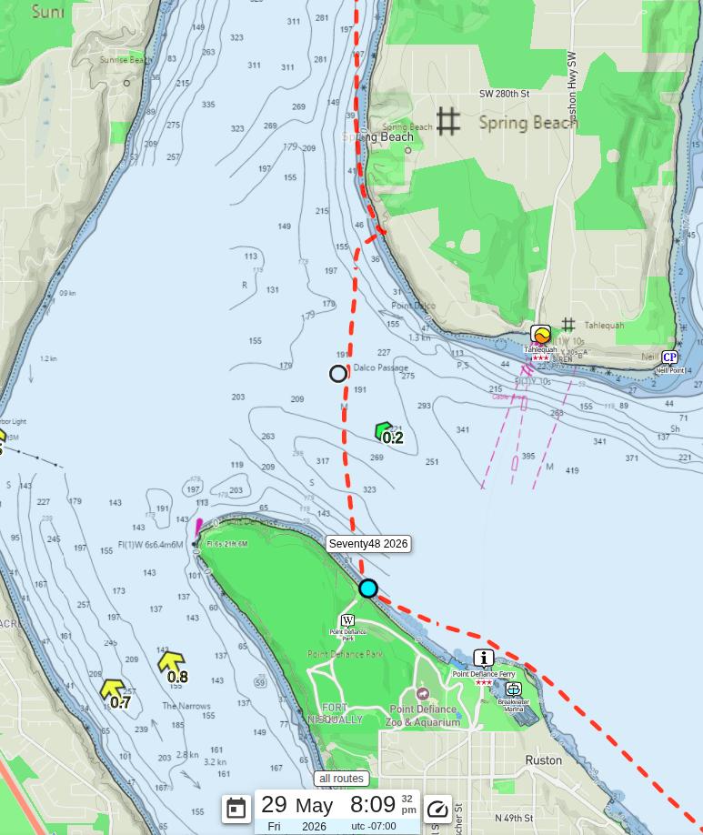
After clearing the waypoint, I set my sights on Colvos Passage. The thought that kept nagging at me was that it felt too early in the race for whitecaps and a headwind. If this was what the evening looked like, what was the night going to throw at us?
As I approached the entrance to Colvos, I pulled over to the Vashon Island shore to flip on my stern and bow lights. Then I climbed back in and paddled into the passage.
Lisabeula
The headwind followed me up Colvos Passage, but the waves were much more manageable than the crossing from Owen Beach had been. I’ll take it.
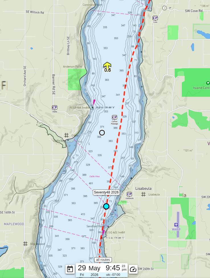
The sky was overcast and the sun was nowhere to be seen, but I still made it to Lisabeula Park before the light left the sky completely. Lisabeula is about 12.3 miles into the race, and I passed through at around 9:45 PM. That put me about 10 minutes ahead of last year’s pace, which was remarkable considering last year had far less wind. I was happy with where I was.
By the time I reached the shore near Cove, just north of Lisabeula, it was fully dark. All I could see were scattered sets of bow and stern lights dotting the water around me. As I was approaching shore, a voice called out from a nearby boat: “Pandatrax?!” I couldn’t believe it. It was Jim. Somehow, out of all the lights on the water, he had recognized my stern light. We had not seen each other since before the ferry crossing. I still have no idea how he picked me out.
We had a good laugh about it, then decided to pair up and cross from the Vashon side of Colvos to the Kitsap side together before heading toward Southworth.
Crossing Colvos/ Second Ferry / Blake Island
The crossing we had planned was not straight across. We angled it, which stretched the distance to about 2.5 miles. As we got further from land, the headwind and waves pushed back harder. Paddling in the dark with waves coming at you from an angle is genuinely fun if you’re in the right headspace, and I was. We started the crossing at around 10:43 PM and made it to the other side in about 30 minutes. As we neared the far shore, the waves settled down and the world got a lot quieter.
By the time we passed the Southworth Ferry terminal, the wind had nearly vanished and taken the waves with it. The ferry was sitting in the dock as we slipped behind it, and we were well clear of its route before it got moving. No drama there. A welcome change of pace.
Jim and I reached Blake Island at around midnight and pulled ashore together for a short break. Blake is roughly the quarter mark of the race at about 21.8 miles, and it is a natural spot to catch your breath.
While I was on shore I did what I always do at every stop: ran the math. Five hours and nineteen minutes to cover 21.8 miles works out to about 4.1 mph. To finish in under 20 hours, I only needed to average 3.2 mph for the remaining 46.7 miles. Nearly a full mile per hour of cushion. I was in great shape.
This year I kept the break short. I stretched, had a snack, did my math homework, and got back in the boat. Jim decided he wanted to linger on the island a little longer, so he wished me luck as I pushed off. That was the last I saw of him on the water, but I knew I’d catch up with him again at the finish. I was back on the water at 12:19 AM, about an hour and five minutes ahead of last year’s pace at the same point. The difference? Last year Blake Island had a few more surprises in store for me. This year it did not.
Third and Fourth Ferry Crossings
I made it to Restoration Point at the southern tip of Bainbridge Island without any trouble, which also meant I had quietly crossed the Bremerton Ferry route without a second thought. Another ferry crossing down.
The Bainbridge crossing was a different story. As I passed Blakely Rock at 1:08 AM, I started doing the math on the ferry schedule and did not love the answer. The last Bainbridge Island Ferry was supposed to depart at 12:55 AM, and I had not seen it leave yet. I had my radio on and was scanning the right channels, so I decided to press forward and deal with whatever came.

Sure enough, just as I was approaching the ferry route, I heard the ferry come on the radio to announce it was leaving the terminal. I knew from experience that the ferry has to move carefully at first while maneuvering out of Eagle Harbor, so I had a window. I just needed to clear a buoy at the south end of Tyee Shoal before the ferry made its turn south in my direction.
Then something unexpected happened. The ferry stopped and hailed VTS, apparently because nobody had told them about the race. A couple of boats were blocking the channel ahead of its first turn. While the ferry sorted that out, I was already past the buoy and well into the clear. By the time it got moving again and reached the end of the shoal, I was long gone.
I rolled past Yeomalt Point at mile 28.2 at 1:51 AM, an hour and forty minutes faster than last year at the same spot. The ferry drama had cost me almost nothing.
Skipping Fay Bainbridge / Saturday Morning Sunrise
My original plan was a straight shot from Skiff Point all the way up to Jefferson Point, about a 6 mile open water crossing. It would keep me well clear of the shipping channel and let me skip Fay Bainbridge entirely. Fay Bainbridge is a lovely little state park just shy of the halfway mark, with nice bathrooms and what racers call “trail magic.” Race watchers set up there and hand out food, coffee, and snacks to anyone who pulls in. Sounds great, right? It is a time trap. Everyone stops there, everyone lingers over a warm cup of something, and suddenly you have lost hours you did not budget for.
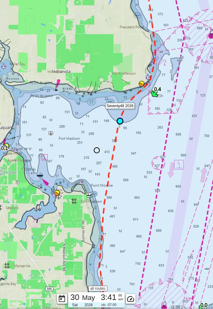
When I left Yeomalt Point, visibility was not great. Dark sky, overcast, the whole package. I could make out Skiff Point about 2 miles ahead, but Jefferson Point which was far to the north of me was another story. I could not pick it out with any confidence. So I adjusted. Rather than the bold diagonal crossing, I stayed closer to shore, following the Bainbridge coastline until I was just south of Fay Bainbridge park, and then cut a bit further west across Port Madison before making my move. It was a little longer, but with a slack tide there was no current to sacrifice. Being a little safer in the dark felt like the smarter call.
Somewhere in the middle of the crossing I came across another racer in a rowboat. We said hello, wished each other luck, and went our separate ways into the dark. One of those quiet race moments that you remember.
I reached Point Jefferson at 4:02 AM, an hour and 45 minutes faster than last year at the same spot. Of course I immediately ran the numbers. Nine hours and two minutes to cover 36.3 miles works out to 4.0 mph. To finish in under 20 hours I only needed 2.9 mph for the remaining 32.2 miles. I was more than halfway through the distance with more than half the time still in the bank. The math was looking very, very good.
And right around then, I noticed something on the horizon. The faintest hint of light beginning to show in the eastern sky. Sunrise was coming.
Fifth Ferry Crossing / Kingston
Paddling through Appletree Cove was smooth and uneventful, right up until I was crossing the Kingston ferry route. I had just cleared the eastbound lane and was picking my way through the westbound lane when my radio crackled to life.
“Good Morning!! This is the Walla Walla!”
I will just say that this particular skipper was having himself a phenomenal morning. Almost immediately after the announcement, I heard the engines wind up and the Walla Walla came tearing out of the terminal. First run of the day, full of enthusiasm. I paddled faster.
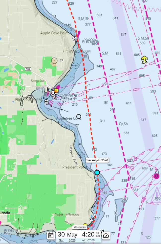
As I came around Apple Cove Point and left Appletree Cove behind, I was treated to one of the nicer moments of the race: the Point No Point lighthouse sitting on the horizon about 7 miles to the north. A good landmark, and a reminder that the finish line was not as far away as it had been a few hours ago.
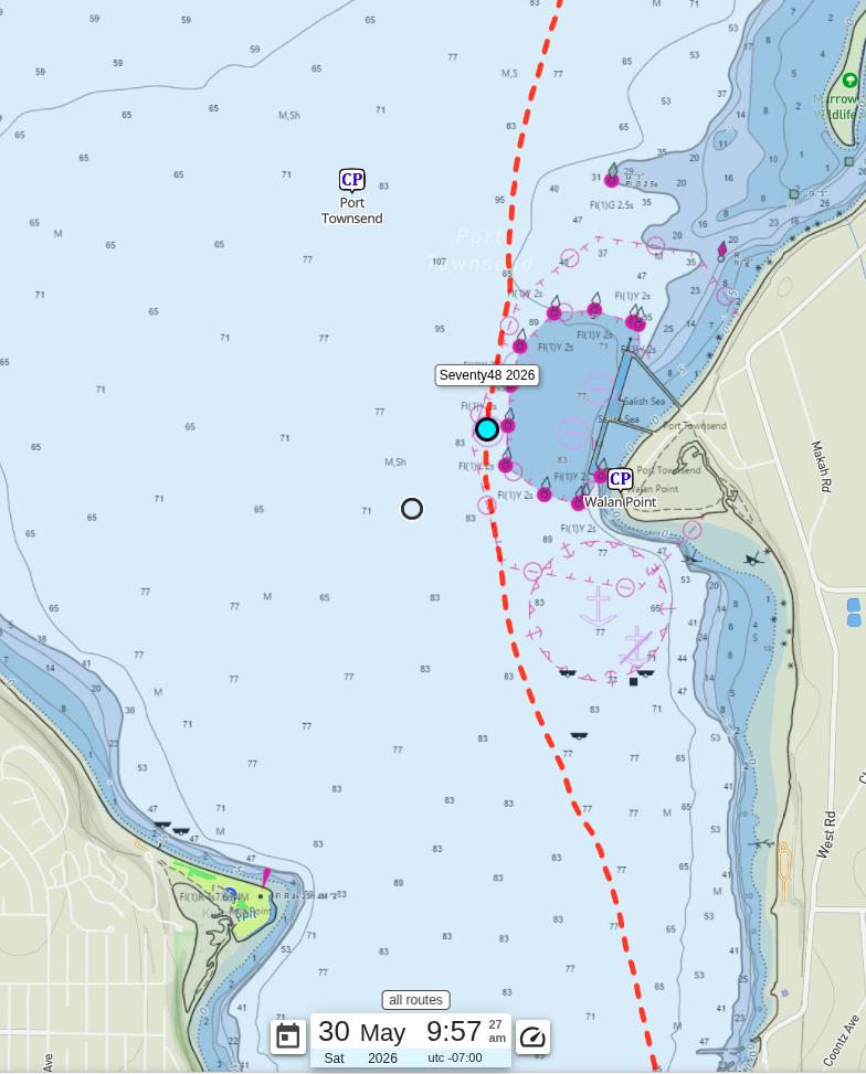
Point No Point / Hansville
Point No Point sits at mile 48 and marks the beginning of the most notorious stretch of the race. Both the Point and the nearby town of Hansville are popular stops for a couple of reasons. The first is comfort: Hansville has a portapotty, the Hansville Grill, and all the food, ice cream, and general comfort that a suffering racer could want. The second, and bigger reason, is that this is historically the exact spot where the weather turns. Every year, racers arrive at Point No Point to find the pleasant conditions they have been enjoying for the past several hours have quietly been replaced by wind, whitecaps, and regret. Stopping starts to feel very reasonable very quickly. Hansville and Point No Point are the Sirens of the race course. Beautiful. Welcoming. And very, very dangerous to your finish time.
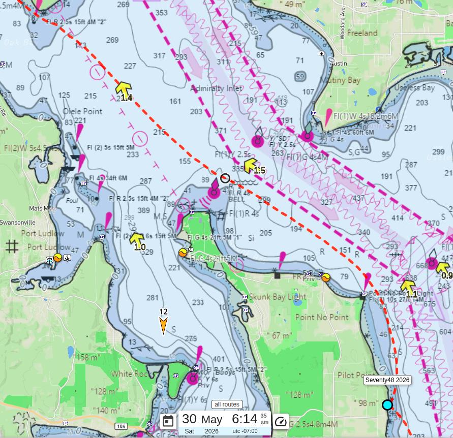
My plan going into this section was to stay away from shore as much as possible, but outside the shipping lane. The currents out there were forecast at 1.4 to 2.1 knots running north, which is exactly the direction I wanted to go. The idea was to use that current to slingshot around Point No Point, blow past Hansville, and if the conditions cooperated, skip Foul Weather Bluff entirely and go straight for Marrowstone Island. Foul Weather Bluff in bad conditions is an absolute disaster zone, and I wanted no part of it.
As it turned out, the weather was beautiful. I could not believe my luck. As I pulled away from shore and started working the current, things started moving fast. I passed Point No Point at 6:45 AM, staying about a third of a mile offshore. That was 2 hours and 45 minutes faster than last year at the same point. I passed the Hansville Grill at about 0.7 miles offshore, and at my closest point to Foul Weather Bluff I was nearly a mile out. The current did exactly what I had hoped. At one point I clocked 8.5 mph without paddling particularly hard. I was flying.
Somewhere out there I caught up with Team Ataka Chicho and we spent a few miles paddling and rowing alongside each other, enjoying the speed and the rare luxury of good company and good conditions. Before we reached Marrowstone he decided to ease off the pace a bit. We agreed to find each other at the finish.
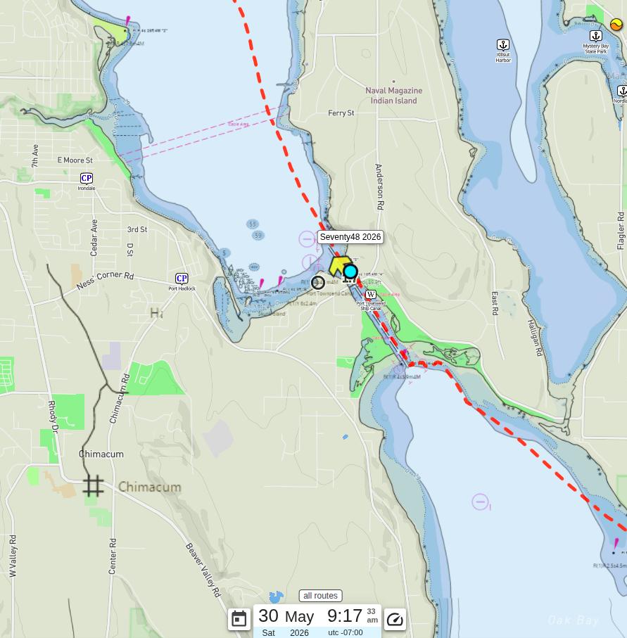
Second Checkpoint / Free Donut
The Cut is a navigable shipping channel between Port Hadlock and Indian Island, and it marks the second official waypoint of the race. Once you clear the bridge, you are in Port Townsend Bay with about 6 miles left to the finish. That’s it. That’s almost the whole race done.
My timing plan for this section was based on the tidal current. Before 10:05 AM, the current runs north through the channel, which is exactly the direction I needed to go. Right around 10 AM it would hit slack and then turn south, and suddenly you are fighting up to 3 knots instead of riding it. My plan was to reach the south end of Marrowstone Island, about 2 miles from the bridge, by around 9:30 AM and enter the Cut while the current was still working in my favor.
I need to back up and explain something. Mary had plans to meet a friend at the Gorge for a concert Saturday evening. Based on the original timeline, she would have just barely enough time to watch me cross under the bridge before she had to leave. She wouldn’t make the finish. But she would be on that bridge, and that was the plan.
Then I went and arrived an hour and fifteen minutes early.
I reached the south end of Marrowstone at 8:14 AM, 6 hours and 15 minutes faster than last year, and immediately texted her. She said she was watching. What I didn’t notice until I was already in Oak Bay, about a mile from the bridge, was that she had also asked me to text her when I was an hour away from the bridge. I called her on the spot. She asked if I could wait at the mouth of the channel while she got into position. She had a surprise. I said no problem. I was genuinely happy to stop paddling for a few minutes.
I held position at the entrance to the Cut for about 25 minutes. With a 3-knot current running north I had to hang out at the entrance. Once she gave me the all-clear, I headed in.
Looking up at the bridge, I could see three figures. I assumed it was Mary, and two of the regulars who drop donuts down to racers on a line every year. As I got closer, one figure had left, but I could make out Mary filming with her phone and another woman holding a big “Go Pandatrax” sign. The bridge is tall. From the water, faces are mostly shapes. I figured Mary had just recruited a bystander to hold the sign while she filmed.
Then, just before I passed under the bridge, someone started shouting from the shore.
I turned and saw a familiar face in a very recognizable Hawaiian shirt that absolutely had no business being there. My exhausted brain took a full second or two to process what it was seeing. My brother Brandon. Brandon lives on the east coast. We hadn’t seen each other in almost two years. We weren’t supposed to see him until Thanksgiving. He was standing on the bank holding a bag on a wrapped up line, waving at me to come get it. He said the line was 20 feet short, so he had run down from the bridge to hand it off himself. He told me to go, and said they would meet me at the finish.
That’s when it clicked. The woman on the bridge with the sign was not a bystander at all. It was Nicole, his wife, my sister-in-law. I literally said out loud, “I don’t know what’s going on right now!”
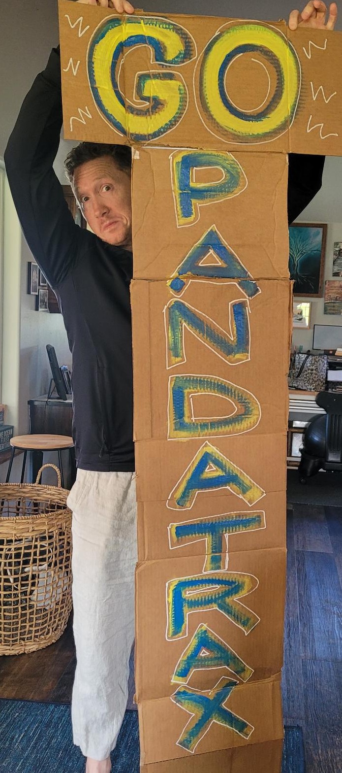
All three of them were cheering as I paddled away. I looked into the bag. There was a donut. And for a single moment, I felt a pang of dread. I had been running on nothing but sweet fuel for fifteen hours. The last thing my body wanted was more sugar. Then I noticed the donut had three pieces of bacon on it. I cannot fully explain how perfectly timed that was. The bacon went first. The donut followed without any complaints.
The bag itself had a note from Brandon written on the side. “Kayakers & fighters have the same mindset: ‘If in doubt, go faster!’ Love you brother!” Brandon is a Navy Pilot and had just gotten home from a deployment, so that line carried some extra weight coming from him. I did exactly that.

Mary had orchestrated the whole thing, coordinated a surprise visit from across the country without me catching even a hint of it. That was the best donut I have ever eaten. I paddled the final 6 miles faster than I had paddled anything all day.
Glassy Water and Munitions
I entered Port Townsend Bay with the donut bag still sitting on my spray skirt. The water coming in was almost completely flat, like glass. The race media team was out on the water and I have a feeling they got a very flattering shot of me paddling along with a crinkled white bag in my lap. Too bad I hadn’t waited to eat my donut, they would have gotten some better shots.
Naval Magazine Indian Island (NAVTAG) is a 2,700-acre U.S. Navy munitions facility that sits right in the middle of the bay. You give it plenty of respect and plenty of clearance. Every year I have made sure to stay well away from it. This year, with no wind trying to push me sideways into the island, I cut closer than I ever have before without crossing the boundary line. It was a small thing, but in a race full of calculated decisions, shaving a few extra meters off the route adds up. As I passed the facility the wind picked up just enough to put some ripples on the water, but nothing that gave me any concern.
The Finish
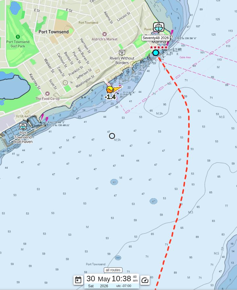
As I made my way toward the finish, I ran into one more surprise: a strong current pushing northeast out of the bay. Even with my bow pointed straight at the finish line, I was getting pushed sideways more than I expected. I ended up having to angle my paddling nearly perpendicular to where I actually wanted to go, crabbing my way toward the dock. After 15 hours on the water, having to fight unexpected current in the last mile is a special kind of frustrating. I paddled harder.
The good news was the Port Townsend Ferry, the sixth and final ferry crossing of the race, cooperated completely. It had already departed toward Whidbey Island before I reached its route, so I crossed without any drama or waiting.
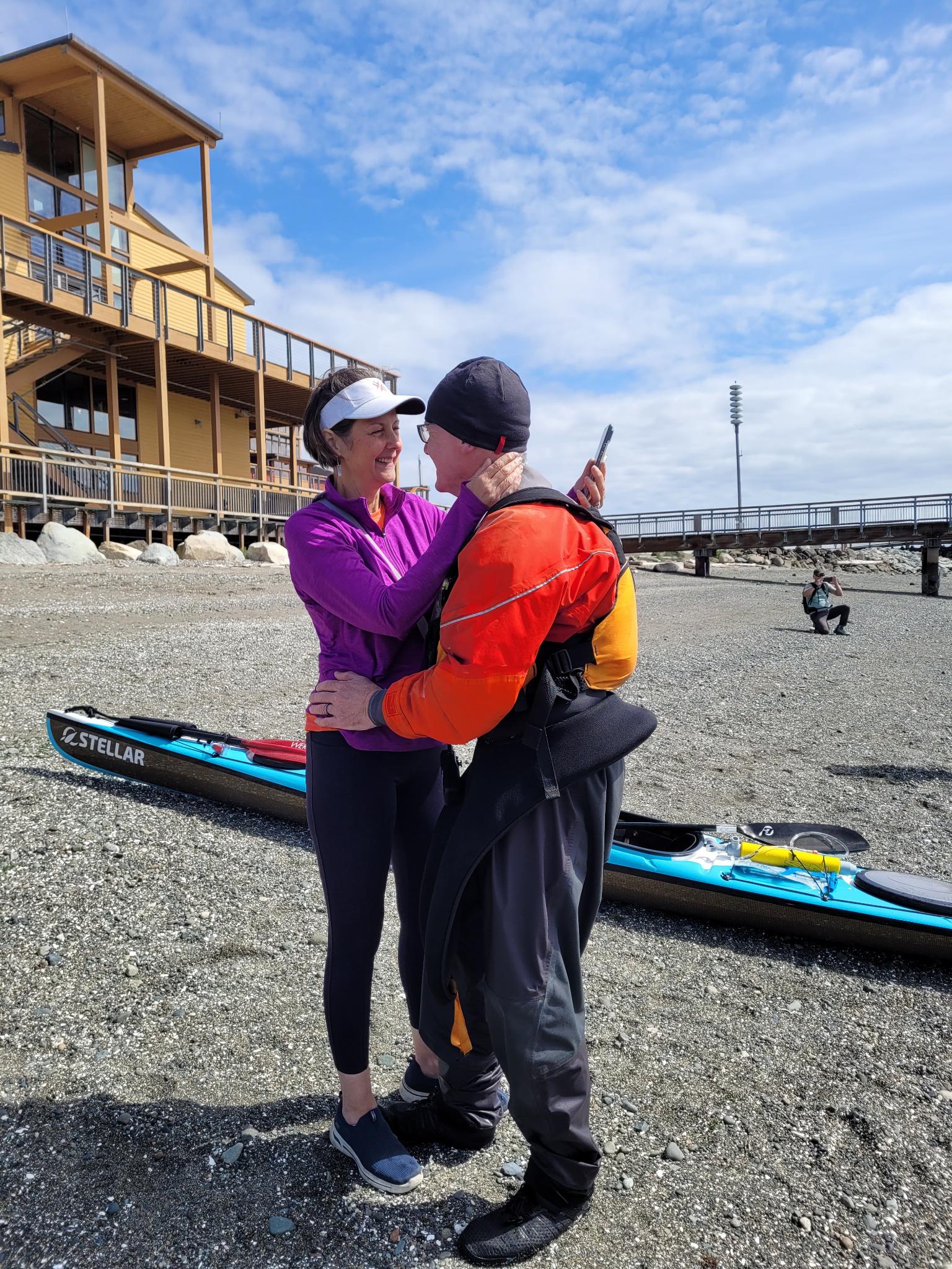
As I paddled toward the finish line, I could make out the faces waiting on the dock. Mary, who by all rights should have been at a concert several hours east. Brandon and Nicole, who were supposed to be on the other side of the country. And Brenna. All of them there, all of them cheering. I won’t pretend I wasn’t crying a little. The support I get from my family is something I will never stop being grateful for.
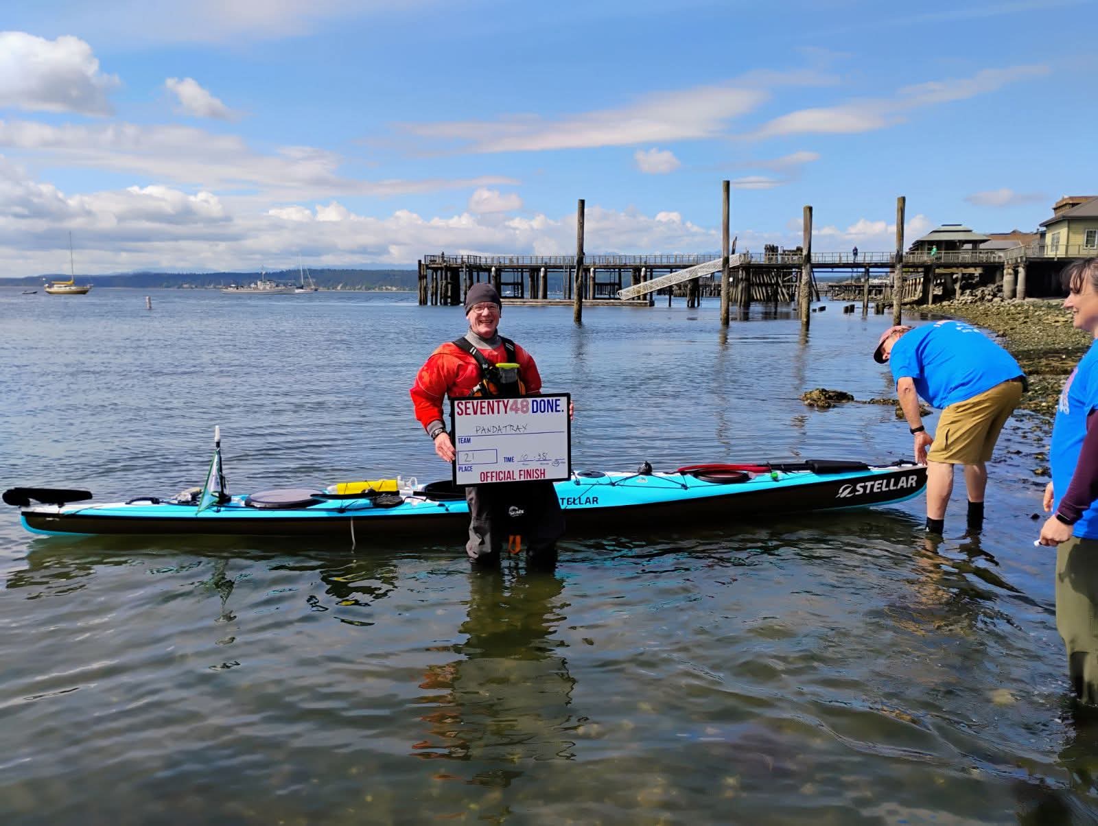
The clock read 10:38 AM when I hit the shore at the finish on May 30th. Fifteen hours and thirty-eight minutes, 68.5 miles from the dock in Tacoma. That is six hours and forty-eight minutes faster than last year.
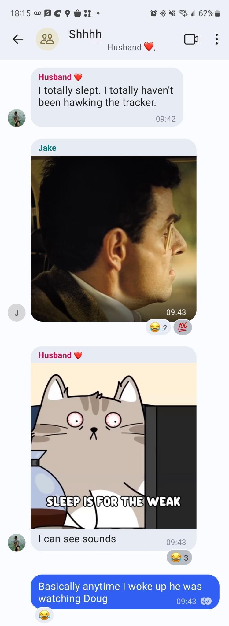
Here is what I did not know until after the race. Brandon had called Mary weeks before the start and pitched the idea of flying out to surprise me. Mary was immediately on board. She quietly cancelled her concert plans. Brandon and Nicole booked flights, flew into Washington the day before the race, and were standing on the shore behind the dock in Tacoma at the start, watching me gear up, saying nothing. They even took video of me before I launched. Creeper footage. Of me. At my own race. And I had absolutely no idea. I love these people.
The whole operation ran out of a secret group chat named “Shhhh.” While I was sitting at the dock prepping my boat, completely oblivious, they were quietly narrating my every move and ducking out of sight whenever I looked up.
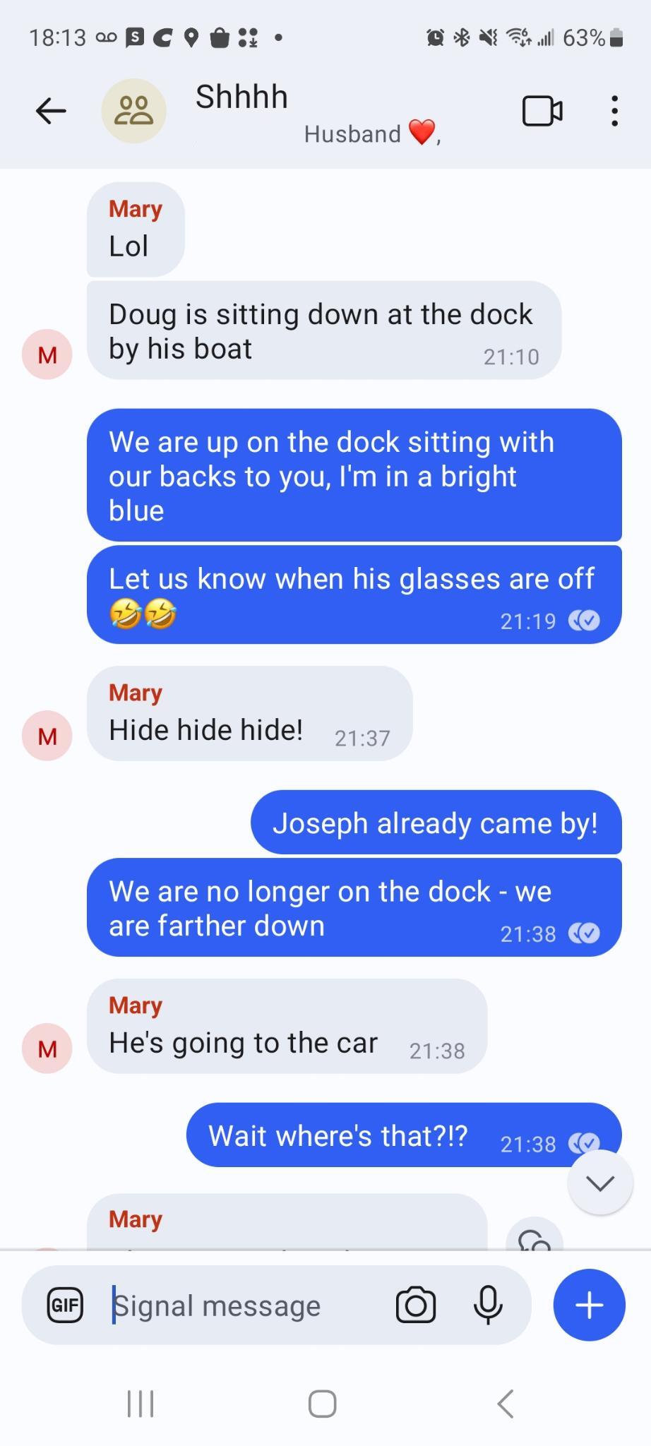
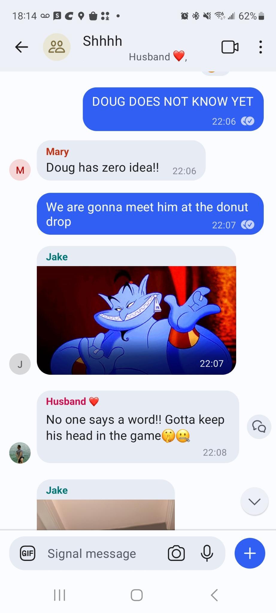
The chat did not stop once I launched. They tracked me through the entire night and into Saturday morning, right up until they ambushed me at the Cut. Apparently Brandon barely slept, glued to the race tracker the whole way.
Neck Tie Event
The necktie ceremony is one of the things that makes this race special. Every racer gets a tie at the finish. Finish the race and you keep it whole. Didn’t make it? A pair of scissors finds the exact spot on the route map where you stopped, and that’s where your tie gets cut.
This year, Mary, Brandon, and Nicole joined me, which was great! Having family there who had surprised me once already during the race made the whole ceremony feel a little more meaningful.
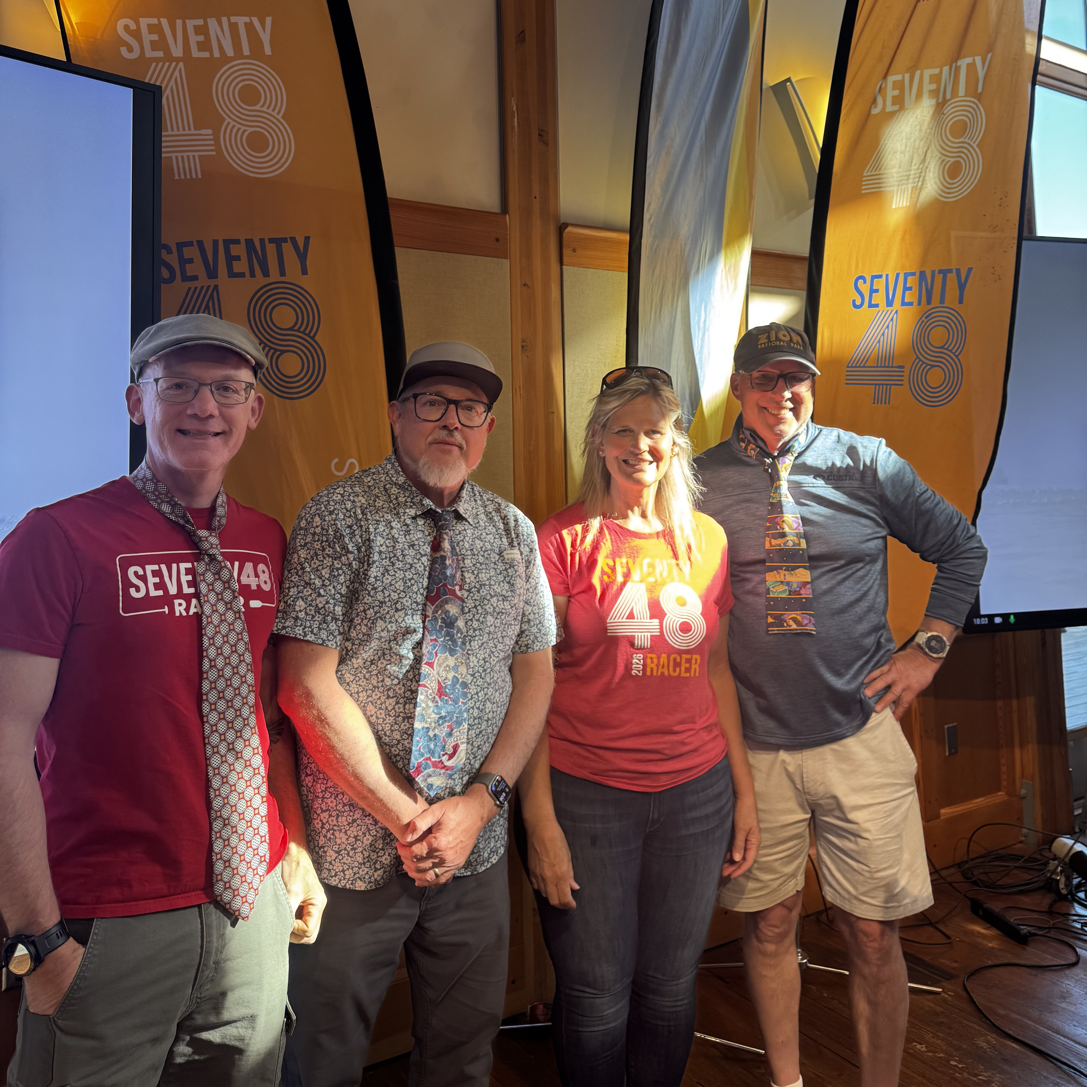
I also got a photo with Jim from Team Wind and Waves and Water and Tom and Carla from Team OctoCosta. The four of us had spent a lot of miles training together in the months before the race, and it felt right to mark the occasion with them. There is something about suffering through the same training paddles in the same cold water that creates a particular kind of bond.
Final Stats / My Thanks
Placing stats
| Teams that started | 133 |
| Teams that finished | 94 |
| My finish time | 15 hrs 38 min |
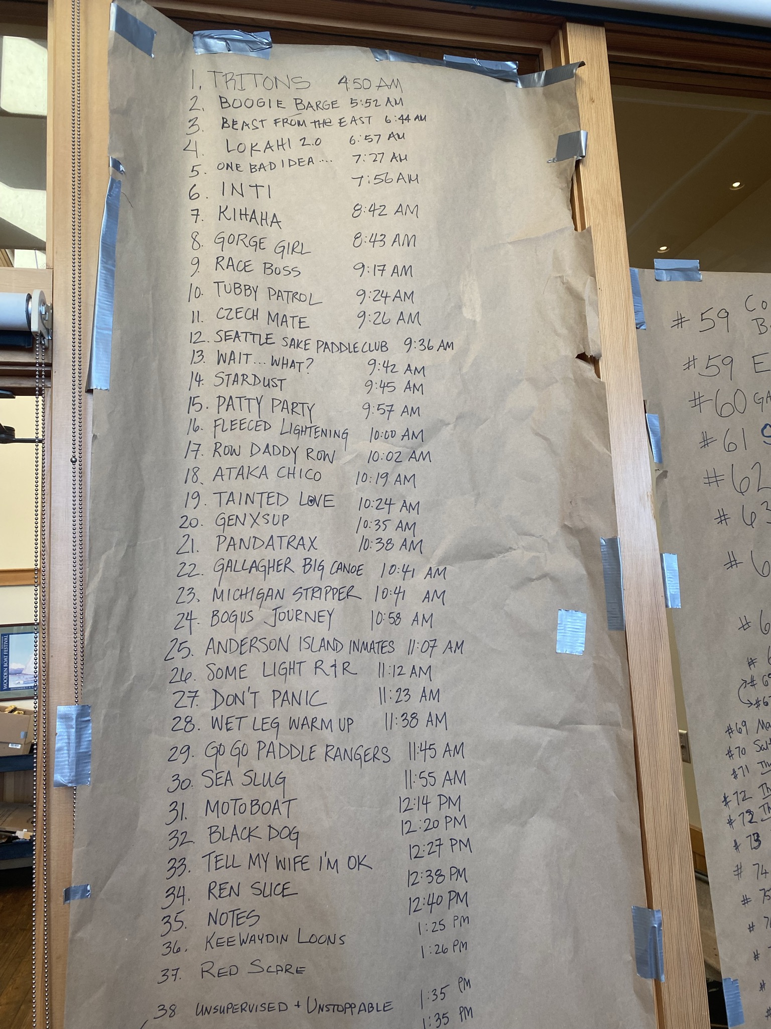
| My place overall | 21st |
| Total # of kayaks | 49 |
| My place in kayaks | 3rd |
| My place in single kayaks | 1st |
Speed stats
| Distance | 68.5 mi |
| Avg Speed | 4.4 mi/hr |
| Avg Moving Speed | 4.5 mi/hr |
| Max Speed | 8.8 mi/hr |
| Moving Time | 15:11:13 |
| Stopped Time | 0:27:34 |
This race does not happen without an enormous amount of work from the people who put it together. Thank you to everyone who organized, volunteered, and showed up on the water to keep racers safe and moving. Jesse and Verity, you two in particular deserve a standing ovation.
To my family: Mary, Brandon, Nicole, Brenna, and Joseph — you are all unbelievable. Flying across the country, cancelling concerts, taking creeper footage at the start, holding signs on bridges, and cheering at the finish line. I could not have asked for a better crew. To the rest of my family and friends who spent the day glued to the race tracker and sending messages of encouragement: it means more than you know.
To my training partners: Jim from Team Wind and Waves and Water, Tom and Carla from Team OctoCosta, and all the other teams I had the pleasure of sharing water with in the months leading up to this race. Every paddle, every crossing, every miserable morning on the water in the cold made this finish possible. Thank you for pushing alongside me.
If you read this entire post, someone should hand you a donut!